| Fort Name : | Alphabetically | RangeWise | DistrictWise | CategoryWise | GradeWise |
| Gadgada (Ghargad) | FortHeight : 3156 ft | ||||
| Type : Hill forts | Fort Range : Amboli Hill Range(Nashik) | ||||
| District : Nashik | Grade : Very difficult | ||||
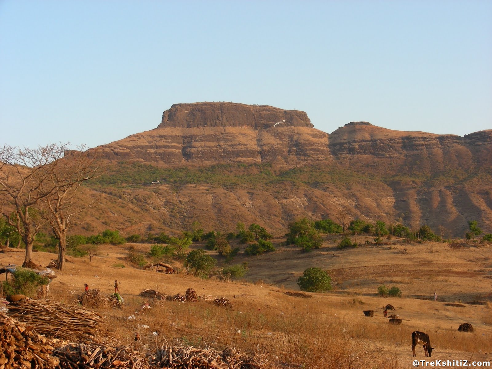
| "Gadgada Sangvi” village is 18 kms from Nashik which unfolds the hill range known as Amboli. There are 3 peak attracts our attention.The right tops ' Amboli 'on the left and Summit ' Aghori'. And the middle peak is known as “Gadgada Fort”. To head this fort Use of climbing mechanism is must. The fort primarily was used as Watch tower. | |||||
|
|||||
| Fascinating Spots : | |||||
.jpg)
| We can observe the group of Veerghal (A Sculpture carved out of stone depicting the heroic life of a warrior) while going back from Gadgada SANGVI village. Youstep on this road, there is well. Potable water is available in Well. Near this Well there is Shiv lingam and Nandi placed,here is a direct straight path to the fort, right path takes you to Hanuman temple, here stay can be taken. 10 minutes’ walk on Straight route takes you at rock patch. This rock patch has been separated with crack from the main. If we take a round of this small rock patch we can observe the small stone steps which are made by villagers.After ascending these stone steps, at right we can observe the distinct rock which has been separated with Crack, and at left we can see fort rocks. Go to the right at first small rock, there is stone craft, after bit of a climb we will be back again from the original fort and in the direction of village Gadgada SANGAVI. Rock patch path takes you goddess Bhavani. For which we have to ascend via stone steps. There are steps to get to the fort from the temple. By having the steps we suppose to reach main entrance of the fort, but British devastated steps.so while descending rappelling is must. We reach the cleft between Gadgada fort and Amboli hill range.Add a detour from the mountains, descending Walking Trails takes you to Amboli. In the last 5 minutes’ walk unfolds the 3 feet cavity. This can be man-made cave crawls (Must be with the torch).Margin in the last cave on the right turns. Local people called the tunnel. However, to see cave precautions has been taken due to scree and hands needs to put in groove. Once we see the Cavity and comes at right side of the fort where(Gadgada SANGVI against the side of the village) is the last stage of the small rock patch.The roots of this plant have been enrouteddeep in rock. We take the help of root of the tree branches and reach the narrow bar on fort. For accessibility information on climbing technique must be known. This is the first rock patch approximately 15 feet in height (Chimani Climb identifies the name). Ascent is somewhat at the end of the first rock patch. Depreciation on the uphill is that you have to walk. At the end of the second ascent is a rock patch. This usually happened is 20 feet. For accessibility there are groove. Rope needs to be tied on tree on the top from where help can be provided to other team members. At the top of the fort one can see damaged entrance and besides it Dewadya. From here carved stone steps can be seen.Due to damaged structure ascending and descending can be done with the help of rope only.Looking at the entrance to the next group to see when you getwater tanks carved in stones. There are 5 steps to enter the water tank .Carving work can be seen in last 2 water tanks. Water is Potable in water tank. Ahead we can observe the damaged structure. Next to this we can observe the group of water tanks where potable water is not available. Beautiful field can be seen from here. Towards west of the fort we can see Dangya Pinnacle, Anjaneri and Valadevi also Mumbai - Nashik Highway, Mukane Dam and belt, Aundha, Bitanagada, these forts and Kalsubai hill range can be seen. By rappelling we can descend at Goddess temple or the way from which we had ascended the fort. | |
| Ways To Reach : | |
| There is Vaitarana junction on Mumbai - Nashik Highway 163 Km from Mumbai (16 km from Ghoti) before the 18 Km of Nashik.2 km from the Junction there is "Vadivhire ". Fell out on the streets, it takes a village. At the traffic circle to the right hand or on the road 4 km "Gadgada SANGVI” of the village is the base of the fort. The erection of a command and the beginning of the road ' Bhavani Temple and Hanuman, Amboli mountain complex, Gadgada SANGVI ' has been written.Every hour there is ST bus to the village Vadivhire from Nashik, but the ST doesn’t drop you at Gadgada SANGVI village. Get down at Vadivhire,4 km walk takes you to Gadgada SANGVI. With private vehicle we can reach Gadgada SANGVI village. | |
| Accommodation Facility : | |
| 10 persons can stay in Gadgada SANGVI village school and in Hanuman temple which is at the half of the height of the fort. | |
| Food Facility : | |
| Nil. Restaurants are available on Mumbai Nashik highway. | |
| Drinking Water Facility : | |
| Potable water is available in the tanks near the entrance round the year as well as in the well near the Hanuman temple. | |
| Time To Reach : | |
| 2 to 3 hours from Gadgada Sangvi village. | |
| Notes : | |
| 1) One requires technical climbing and rappelling expertise to reach the fort. 2) To avoid detention while ascending and descending, it is recommended to carry two different ropes of 100 feet and 30 feet each. As there is a very narrow space between the two rock patches and just before the first rock patch, only 5 to 6 people can stand at one time which is why two ropes are advised to carry. 3) For descending, one has to extend the rope from the doorway down to the temple. It is advisable to use the rope in a “U” format as due to overhang it’s not possible to descend without a rope. Using the rope in “U” format helps in pulling out easily after all rappelling activity is completed. 4) It’s not possible to ascend the fort from the temple as the steps here are broken and the rock patch has an overhang. Only descend by rappelling is possible here. 5) We can seek help from the local guides who are well versed with the rock patches. 6) Free climb is possible for Pinnacle and Wall climbers. |
| Marathi Version |
| Forts in the range of Amboli Hill Range(Nashik) | Gadgada (Ghargad) |