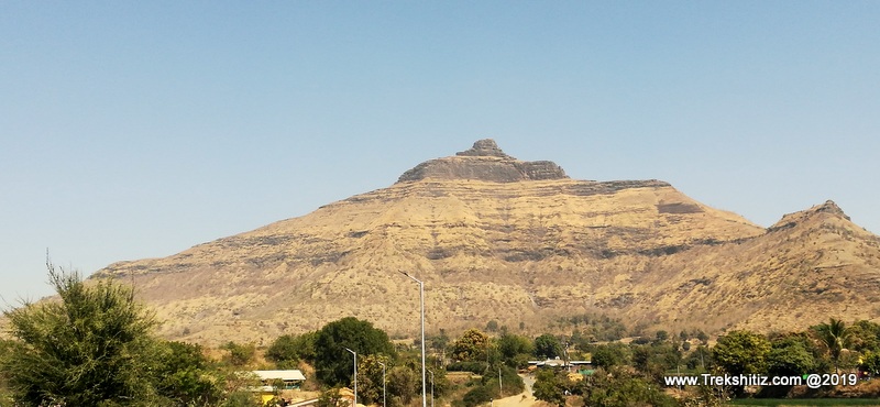
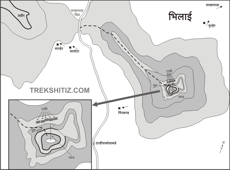
Dagadi Sakode village is 2 kms from the fort and its rocky cap structure is visible from the village. 2 kms from Bhilai on the road towards Patole Sakharpada we come to Sakharpada pass. To the left, here, is the hill of Adhir while to the right is Bhilai fort. After crossing the pass there is a mountain ridge which connects near to the road. We have to ascend on this ridge.
Once we ascend the pass there are some stones on the right side covered with vermillion. After this we have to start ascending towards the hill which stands before Bhilai fort, keeping the hill to our right and the valley to our left, heading towards the rock wall of the fort. This patch has a lot of scree and multiple paths criss-cross each other. Thus it is important to focus on our path leading to the rock wall of the fort else there are chances one would miss their path. From the point where we started from the pass, it takes about 45 minutes to reach the bottom of the west side of the rock wall. From here, keeping the valley to left and rock wall to right we come across a spot in about 2 minutes where some rocks are kept to climb a rock patch. This rock patch is about 10 ft after which there is an unpaved path. This rock patch can be climbed without a rope but it is always recommended to carry one for safety purpose. Once we climb the rock patch we can see the fort edge and the caves below it. While proceeding towards these caves we come across 5 water tanks carved in rock. Moving ahead there is another rock wall we come across and 2 caves. In these caves there are idols of Lord Hanuman, Goddess Saptashrungi and other rocks covered with vermillion. From the caves there is a narrow path leading to the fort summit which is small in size. There is a saffron flag post here. From the fort top we can see Salher, Salota, Mulher, Pimpla, Chaulher forts.
|