Ajoba
Fort Images
Explore Various Images of the Fort
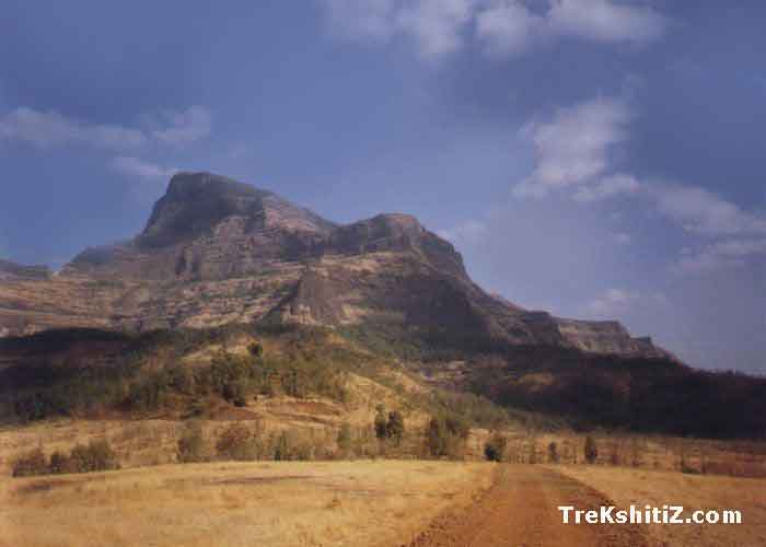
View Mountain Ajoba while moving towards Valmiki's ashram
Maps & Routes
Explore detailed maps and trekking routes to reach the fort
No maps available yet
Browse All MapsPoints of Interest
Near the Ashram, there is a small hut where we can stay. A small water stream provides us with pure water. The way beyond Ashram leads to a rivulet, crossing which we can reach the cave of ‘LUV-KUSH’. To reach this spot we have to ascend the way of waterfall for one and half hour. Above this cave there is a precipice called 'Cradle of Sitamai'. In the cave there are the carved “Padukas” or the footprints of Luv and Kush. This precipice is a real challenge for trekkers.
The ashram is a sacred place and people from all over Maharashtra come here. There are some carved stones near the ashram, on which some carved idols depict some story.
From this place, we can visit Ratangad. For a 5-day cross-country trek, the trio of Ratangad - Harishchandragad-Ajoba can be planned.
Facilities & Amenities
Accommodation
Near to the ashram, there is a hut where about 20 people can stay. Care should be taken from snakes and scorpions. Generally people prefer this place as one-day trek, especially in rainy season. A beautiful waterfall is formed in monsoon.
Food
One should make arrangement for food.
Water
The water stream provides us drinking water.
Best Season to Visit
🌤️ N/A
Nearby Villages
Dene
Other Forts in Shahapur
Planning Your Trek?
Pack Smart
Carry essentials, water, and first aid kit
Start Early
Begin your trek early in the morning
Trek in Groups
Always trek with companions for safety
Keep Forts Clean
Do not litter on forts. Do not damage the fort.