Darya Ghat
Maps & Routes
Explore detailed maps and trekking routes to reach the fort
No maps available yet
Browse All MapsIntroduction
To transport goods arriving in the ports of Kalyan and Shoorparak (Nalasopara) etc in the Konkan region to beyond the mountain ranges in the marketplace of Junnar, many passes(Ghats) were built. Of these passes, Naneghat is one of the well known routes. Apart from that Darya ghat is also one of the routes which was built for the same purpose. The forts of Durg and Dhaokba were built for its protection. Near Darya ghat in Palu Sonavale village there are caves named Ganesh Gadad. A two day trek can be done by following the route of Durg fort - Dhakoba fort - Darya ghat. The information of both the forts is available on our website.
Points of Interest
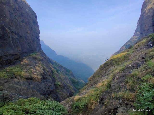
Palu Sonavale is the base village of Darya ghat on the Konkan side. The route to Darya ghat is from Singapur village which is one of the hamlets of the base village. In a short time on this path we come across a dense forest cover and this route takes us to the base of the cleft of Darya ghat. It is recommended to take a local guide for this route as there are high chances of missing in this dense forest route. The narrow pass between two hills is called “Nali” in local language which typically means ‘Like a funnel’. As these passes lie between two mountain walls there are many rocks which loosen from the mountain and fall in this pass. Thus we have to climb up this pass bypassing these huge rocks. To reach atop the pass it takes approximately four hours. Here, we can see some rocks covered with Vermillion. The base village of Palu Sonavale and the lake can be visible from here. To the left we can see Naneghat and its Thumb hill and Jivdhan mountain range. To the right there is the mountain range of Durg and Dhakoba forts. Once we climb the Darya ghat and descend another hill, we reach Amboli village. Time taken to reach from Darya ghat to Amboli village is about 6 hours while it takes about 4 hours for the reverse descending route.
How to Reach
1) Via Amboli :- From Junnar, state transport buses are available to reach Amboli via Aptale village. Before Amboli there is Ucchil village till which one can reach by taxis. From the path which ends in Amboli village, a route goes towards Darya ghat. On this route after we cross a hill, the path to the right goes to Darya ghat while the path to the left goes to Dhakoba fort.
2) Via Palu Sinavale :- Kalyan - Dhasai - Palu Sonavale - Singapur distance is 65 kms. The route for Darya ghat starts from Singapur village.
Facilities & Amenities
Best Season to Visit
🌤️ June to September
Planning Your Trek?
Pack Smart
Carry essentials, water, and first aid kit
Start Early
Begin your trek early in the morning
Trek in Groups
Always trek with companions for safety
Keep Forts Clean
Do not litter on forts. Do not damage the fort.