Hanumantgad(Sindhudurg)
Fort Images
Explore Various Images of the Fort
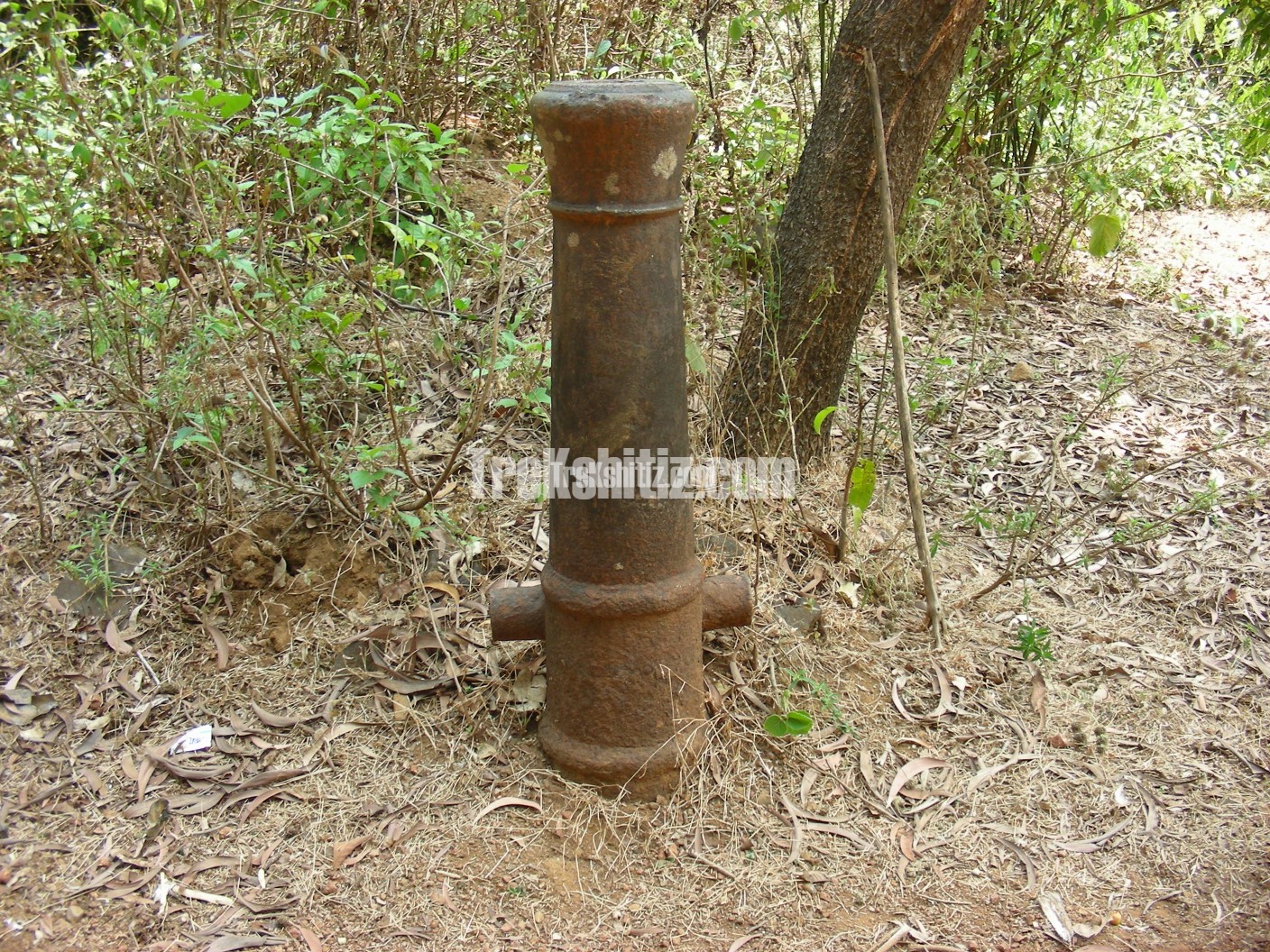
Cannon in base village Fukeri Hanumantgad
 1.JPG)
Historical Background
The Fond Sawants of Sawantwadi built this fort mainly to seek protection from the Portuguese and Karvirkars. Later in 1838, when the British took over Sawantwadi, Aatmo Chaukekar and his colleagues gained control over the fort in a rising against the British but later due to internal conspiracies the attempt failed.
Points of Interest
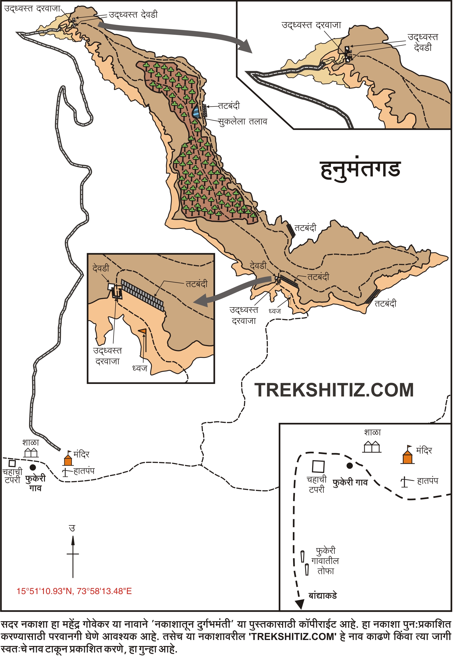
An unpaved road from Fukeri villages leads us to the mountain to the North. Short distance from here a walking trail takes us to the plateau circumnavigating the mountain, keeping the fort to our left. On the upper side to the left we can see the entrance gate of the fort which is in ruins. The ascend till here is quite exhausting. A saffron flag and ruins of fortification wall can be seen. Moving alongside this we enter the fort through a South facing gate. The plateau of the fort is quite big and the citadel could have been built in the middle of the plateau. Walking across the right edge of the plateau we come across ruins of the fort wall and a built lake towards the north. Moving east from the lake leads us to a devastated entrance which might be the main doorway to the fort considering its make. Further from here we come to the South facing doorway which completes the fort trail. Apart from this there are two cannons buried upside down in Fukeri village on which the make year of 1783 is inscribed.
How to Reach
Banda is on the Mumbai-Goa highway, from here a road goes to Dodamarg. 7 kms from Banda on this road take the left diversion for Talkat village which is further 6 kms. In the village there are two roads alongside Penganga Bank of which the one to the left takes us to Jhombale village at 3 kms. Further again the road divides in two and the one towards the right goes to Fukeri village at 3 kms.
Trek Duration
⏱️ 30 minutes from Fukeri village.
Facilities & Amenities
Accommodation
One can stay at the Grampanchayat office, school and temple in the village.
Food
There is only one hotel in the village. If pre-ordered, food can be made available.
Water
Nil. Available in the village.
Best Season to Visit
🌤️ N/A
Additional Information
It is recommended to take a route guide from the village.
Planning Your Trek?
Pack Smart
Carry essentials, water, and first aid kit
Start Early
Begin your trek early in the morning
Trek in Groups
Always trek with companions for safety
Keep Forts Clean
Do not litter on forts. Do not damage the fort.