Jangli Jaigad
Fort Images
Explore Various Images of the Fort
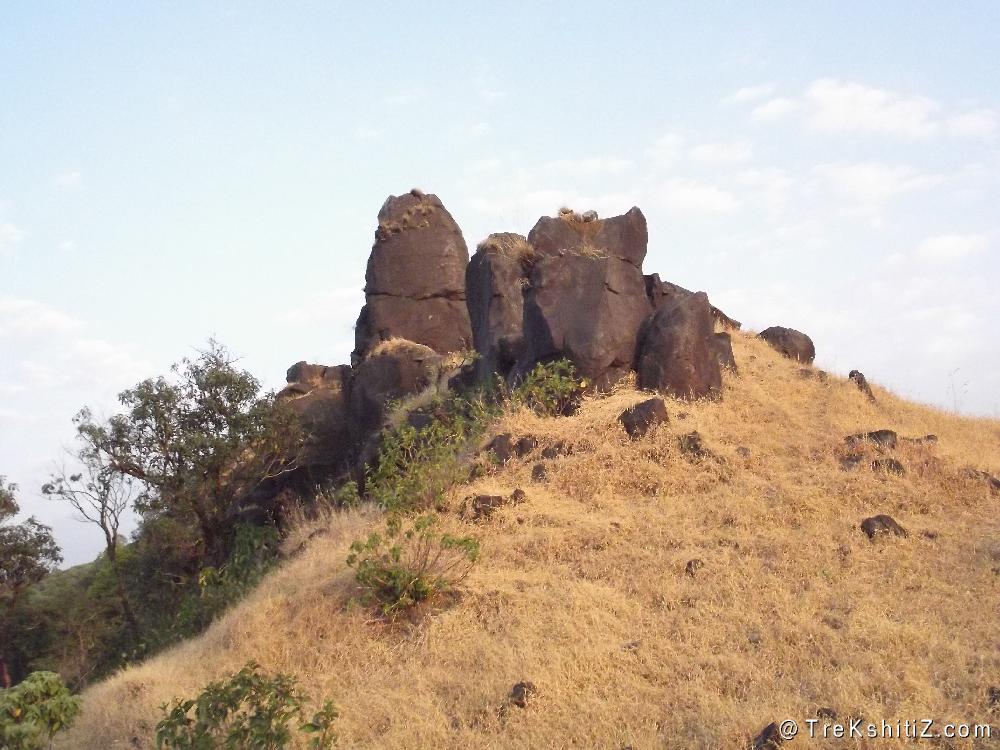
Small pinnacles on Junglee jaigad called as Deepmal
Maps & Routes
Explore detailed maps and trekking routes to reach the fort
No maps available yet
Browse All MapsIntroduction
Jangli Jaigad, the name which itself says fort nested in deep dense forest is located 12 kms from the biggest dam of Maharashtra, Koyna in Koynanagar village. Wild animals like Tiger, Leopard, Sloth Bear etc roam freely in the protected sanctuary here. Overnight stay is prohibited on this fort. As this fort is located on the plateau region, the Konkan region can be viewed which lies at the sea level. The location of this fort would have been used to keep a vigil on the Kumbharli ghat region. The trek to this fort is easy and passes through dense forest. It can be done in single day.
Points of Interest
This fort was built on the mountain range which is broken from the main Sahyadri hills. The access is from Koynanagar side towards Konkan region from where the fort’s devastated entrance is located and hidden in trees. It can be identified by its stone built structure. While going to the fort we have to circumvent two rock pinnacles which are referred as “Deepmaal” by the locals. As we move ahead from these pinnacles there is a temple and an idol of a Goddess both of them are now in ruins. To the edge of the fort a Saffron flag is mounted. To the right side below we can see Kolkewadi dam and Kolkewadi fort next to it. To the front the town of Chiplun and Vasihthi creek can be seen. In clear weather traces of the Arabian Sea can also be visible. To the left lower side there is Kumbharli ghat. The entire fort can be visited in 30 minutes.
How to Reach
Koynanagar village is 43 kms from Chiplun on Chiplun-Patan-Karad route. Navja village is 11 kms from Koynanagar from where S.T. buses can be available to reach. 500 mts on the road towards Panchdhara tunnel there is a check post. After crossing this check post at about 500 mts there is a small unpaved road to the left approaching the hill. One can reach up to here with one’s own private vehicle. The trail starts from here which passes through dense forest cover. After a 30 minute walk we come to a stream. Water can be available here till the month of February. In further 15 minutes we cross over the main Sahyadri hill range and reach the Konkan side. Here in the front we can see the hill range on which the fort is built. It takes 30 minutes from here to reach the fort edge.
Trek Duration
⏱️ 1hr15 mins from the base
Facilities & Amenities
Accommodation
Available in Koynanagar village or the local school in Navja village.
Food
Available in Koynanagar.
Water
Available in the stream which is on the way.
Best Season to Visit
🌤️ N/A
Additional Information
1) Hre a local guide from Navja village as the forest officers stationed at the check post won’t allow otherwise. It will also help to navigate easily in the dense forest area.
2) There is no route to descend in the Konkan region. Thus the ascend route is the same for descend.
Planning Your Trek?
Pack Smart
Carry essentials, water, and first aid kit
Start Early
Begin your trek early in the morning
Trek in Groups
Always trek with companions for safety
Keep Forts Clean
Do not litter on forts. Do not damage the fort.