Mrugagad
Maps & Routes
Explore detailed maps and trekking routes to reach the fort
No maps available yet
Browse All MapsIntroduction
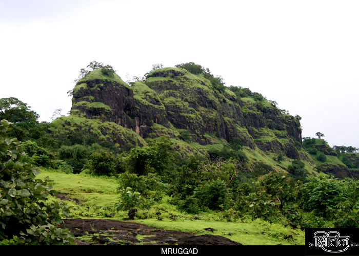
Khandala – Lonavla are famous for monsoon treks, waterfalls and trips. We are familiar with Tiger Valley on the way to Bhushi dam. Mrugagad is situated in the Tiger Valley. The way to reach this fort is from Khopoli.
Points of Interest
Mrugagad is a small fort, and it takes around one hour to see it. On the way to the top, there is a cave which is bit tough to ascend. There are some water tanks and a small pond on the fort. There are some water tanks on the summit. We can find some remnants of old houses. Since Umbarkhind and Waghdari can be seen from the top, it was used to keep a watch on these areas and the surrounding villages.
How to Reach
We have to reach Khopoli station. From there, we can get share rickshaw for Lonavla Phata. From here, we have to take share six-seater to Parali village on Pali-Khopoli road. Six-seaters are available from Parali to Bheliv village, which is the base village. Amongst the three mountains near village, middle one is Mrugagad. It takes around 1 hour to reach to the top of the fort. The way is through dense trees, along the valley between the fort and Third Mountain and then over a rock patch to the top.
Facilities & Amenities
Accommodation
None
Food
None
Water
None
Best Season to Visit
🌤️ N/A
Other Forts in Lonavala
Planning Your Trek?
Pack Smart
Carry essentials, water, and first aid kit
Start Early
Begin your trek early in the morning
Trek in Groups
Always trek with companions for safety
Keep Forts Clean
Do not litter on forts. Do not damage the fort.