Nhavigad
Fort Images
Explore Various Images of the Fort

Nhavigad From Base Village Wadakhel.
Introduction
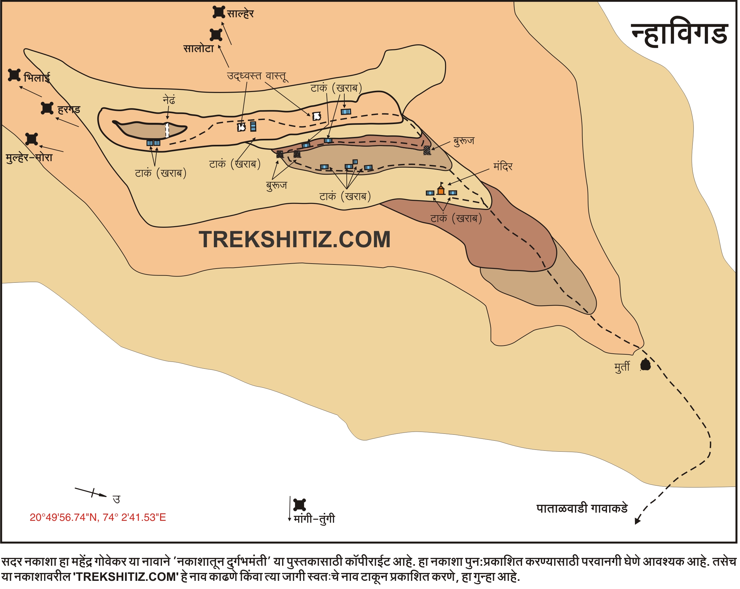
The Western Ghats in Maharashtra start from Baglaan range. This mountain range is situated to the north of Nasik district, near the border of Nasik district in Maharashtra and Dang district in Gujarat. There are 2 distinct mountain chains called Selbaari and Dolbaari. Dolbaari comprises of Salher, Mulher, Mora, Hargad and Salota forts, whereas Selbaari comprises Mangi-Tungi and Nhavigad.
Points of Interest
Nhavigad is also called Rantangad (not be confused with Ratangad from Ahmednagar district). On the way to the top, we can find water tanks and a temple. The steps are still there, but the entrance has been completely destroyed. The fort has a narrow apex, almost like a pinnacle. To reach to the topmost part, some natural vertical climbing is needed. It takes around half an hour to see the fort. There are 3-4 tanks on the fort and remnants of some houses.
Facilities & Amenities
Accommodation
None
Food
None
Water
Available
Best Season to Visit
🌤️ N/A
Other Forts in Baglaan
Planning Your Trek?
Pack Smart
Carry essentials, water, and first aid kit
Start Early
Begin your trek early in the morning
Trek in Groups
Always trek with companions for safety
Keep Forts Clean
Do not litter on forts. Do not damage the fort.