Rawlya
Fort Images
Explore Various Images of the Fort
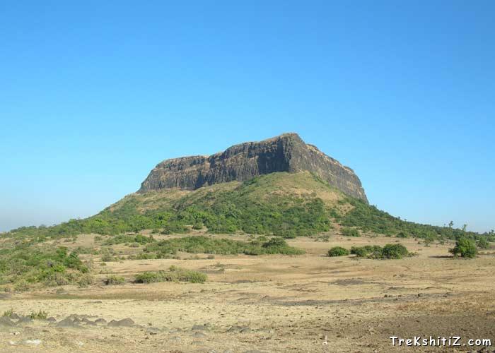
Rawlya From the palteu between Rawlya & Jawlya
Maps & Routes
Explore detailed maps and trekking routes to reach the fort
No maps available yet
Browse All MapsIntroduction
The twin forts of Rawlya-Jawlya are located in the Saatmaal mountain range. These forts are situated on a huge plateau. Rawlya fort is difficult to climb and it is advised to visit this first before Jawlya. both the forts can be visited by a day’s halt from Mumbai and Nashik.
Historical Background
Historical records state that the forts were called as “Rola-Jola”. Aliwardi Khan won this fort in 1626 for the Mughal ruler Shahajahan and later Shivaji Maharaj in 1670. In 1671, Dilerkhan laid a siege to these twin forts which was successfully hampered by the Marathas. After the Marathas, Mahabat Khan took over this fort and then it went to the Peshwas. In 1818, the British rulers captured this fort and Captain Briggs had the steps and fortification wall of the fort devastated in 1819.
Points of Interest
The plateau on which these twin forts are located has a small hamlet with 4-5 houses built by a person named Tiwari and thus this place is named after him. Before entering this settlement area a path to the left leads to Rawlya fort through a forest cover. This path isn’t easily traceable so caution is advised. Once we get on to the path, we reach a cleft in about 15 minute’s time. There is a cave to the right on the route. To reach the fort one has to do a Chimmney climb from this cleft and reach the tree on the top. The broken edge of the fort stands just opposite to the tree from where a route leads us to the fort. To climb this edge of the fort it is necessary to have proper technical climbing expertise and equipment. However experts can do a free climb also. On the upper side there is a saffron coloured flag and there are no remnants on the fort at present. On the other side of the fort there are water tanks which are now dried up. The fort of Markandya can be visible from the top and also the forts of Achala and Ahivant can be seen in clear weather.
How to Reach
3 kms from Babapur on the Nashik-Vani-Babapur-Mulane route there is a cleft where one has to get down. A road to the right takes us to Rawlya-Jawlya while the road to the left takes us to Markandya. It takes 30 minutes to reach the cleft from Vani. Take the right path of the mountain ridge which is well used. After a 30 minutes ascend the path turns to the left and again to the right and takes us on the plateau. From the cleft to the plateau it takes about an hour’s ascend. Rawlya fort can be seen from here in the front but we have to go to the cleft between Rawlya and Jawlya hills. 45 minutes from here takes us to the base after a few patches of dense vegetation. As there are many routes on the plateau there are high chances of being misled by the wrong route and hence caution is advised to always keep Rawlya fort to our left. After crossing the dense patch we come to a hamlet.
Trek Duration
⏱️ Plateau is 2 hrs from Babapur and Mulane-Bari
Facilities & Amenities
Accommodation
The houses in the hamlet can accommodate up to 4-5 persons. One can also camp in the open.
Food
Not available
Water
Available on the fort
Best Season to Visit
🌤️ September to March
Other Forts in Saatmaal
Planning Your Trek?
Pack Smart
Carry essentials, water, and first aid kit
Start Early
Begin your trek early in the morning
Trek in Groups
Always trek with companions for safety
Keep Forts Clean
Do not litter on forts. Do not damage the fort.