Ambolgad
Maps & Routes
Explore detailed maps and trekking routes to reach the fort
No maps available yet
Browse All MapsIntroduction
The two forts in the Rajapur Taluka of Ratnagiri District are Ambolgad and Yashwantgad. The fort of Ambolgad was primarily built to keep an eye on the ancient port of Musakaji and the surrounding seas. Col. Imlock captured this fort for the British in 1818. The residential portion of Ambolgad was shifted out completely by 1862.
Points of Interest
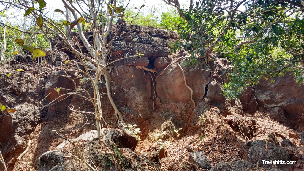
Ambolgad is situated at a height from the main sea level. The total area covered by the fort is approximately 1200 Sq. Metres. It has the sea guarding it from the South and has deep moats on the northern and western side. The current condition of the fort is very bad. A small part of the fortification and walls on the sea side are still visible. Apart from this, there is a square well and remnants and plinths of various constructions in the fort. The Math of Gagangiri Maharaj is situated near the fort.
How to Reach
The route to this fort goes from Rantagiri – Adivare – Nate – Ambolgad. The other route is through Rajapur – Nate – Ambolgad
Facilities & Amenities
Accommodation
No accommodation facility available on the fort. However, one can stay at the Gagangiri Maharaj Ashram nearby.
Food
None
Water
Gagangiri Maharaj Ashram for drinking water
Best Season to Visit
🌤️ N/A
Additional Information
The forts of Jaigad, Yashwantgad and Ambolgad can be done in a single day if one makes Ganpatipule as the base.
Other Forts in None
Planning Your Trek?
Pack Smart
Carry essentials, water, and first aid kit
Start Early
Begin your trek early in the morning
Trek in Groups
Always trek with companions for safety
Keep Forts Clean
Do not litter on forts. Do not damage the fort.