Aundha

Introduction
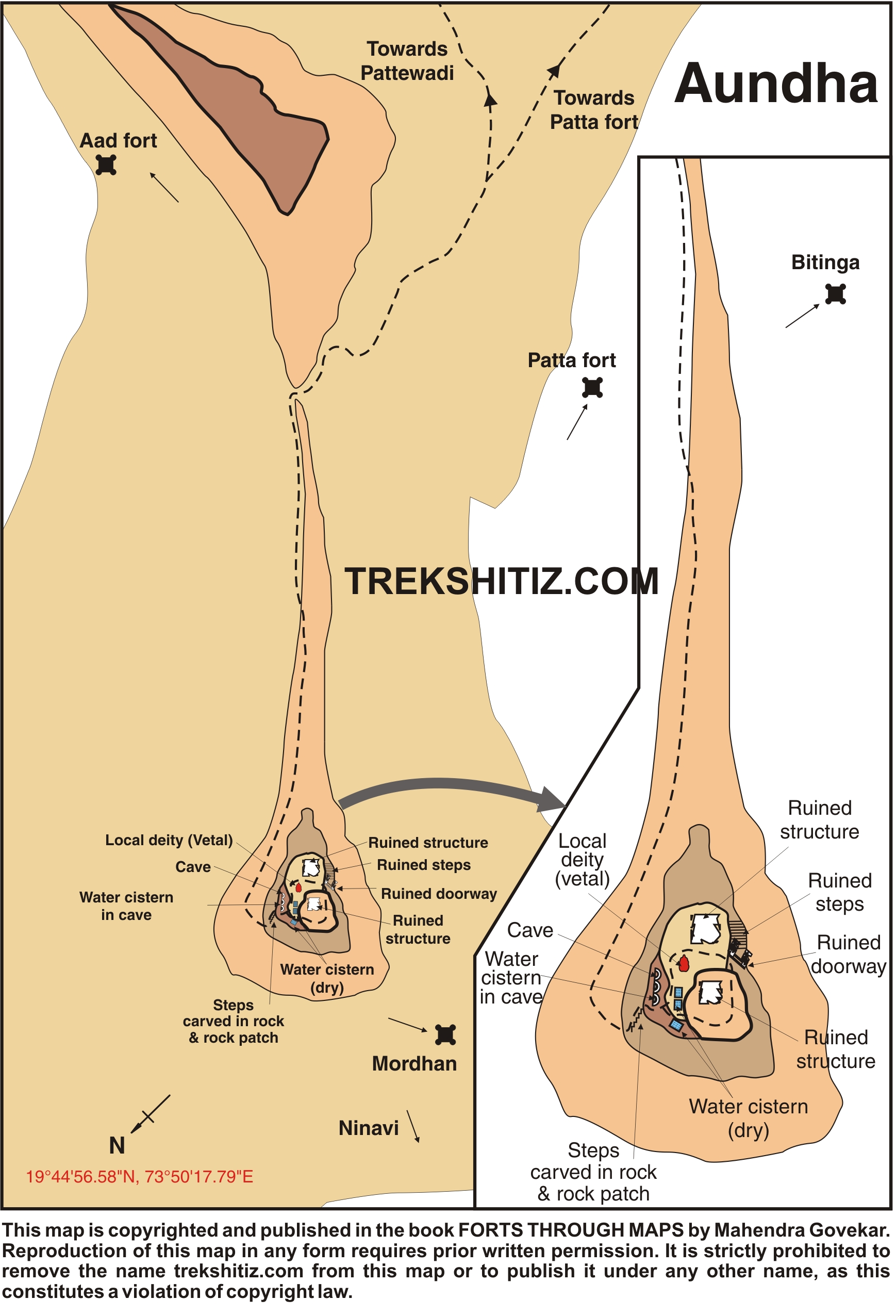
A North-south range of Sahyadri, which turns from Igatpuri towards eastern Thal Ghat, is known as ‘Kalsubai Range’. It is divided into two parts, one being Alang, Madan, Kulang and Kalsubai, and the other at the east is Aundh, Patta, Bitangad, Aad and mountain of Mhasoba.
Historical Background
Till 1688 the fort was under Maratha rule. Then the Mughals captured it and Mughal Sardar Shyamsingh was appointed as the chief of the fort.
Points of Interest
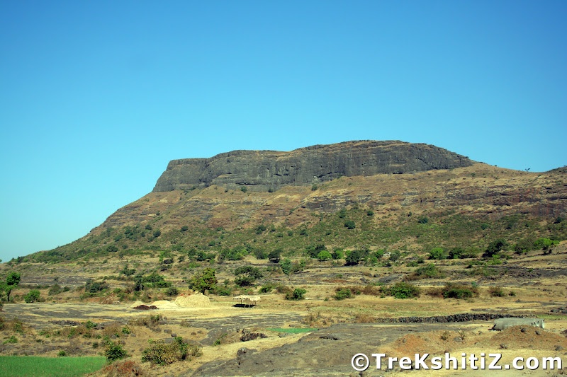
The fort of Aundh is like a pinnacle, since top of the fort is very small. The main use of this place was to keep a check on the surrounding region. We can see 4-5 cisterns on the fort. Water is available in one cave. There is an entrance carved here from the huge rock.
We can see Patta fort, Bitangad, Alang, Madan, Kulang, Kalsubai and the surrounding area from this fort. Half an hour is enough to see the fort.
How to Reach
Go to Igatpuri via Mumbai. Take bus for Bhagur from Igatpuri bus station at 7 a.m. and get down at Kadva Colony Naka. This journey takes approximately one and half-hour. Going further from Kadva Colony we reach at Kadva dam. Going by this way we reach Ninavi village after 45 minutes. Through this village we can go towards the fort by two ways.
1) The first way is through a ridge in the cliff ahead. However this way is quite tiring.
2) The other way goes along the Hanuman Temple. This way takes more time but it is not tedious. This way takes 45 minutes to reach the Plateau. From this place half an hour is required to reach the steps on the fort. After some rock-climbing, we can reach the top.
Many trekkers visit Aundh-Patta-Bitangad together. From Aundh, we can go to Patta by returning to the plateau and heading the way along the flag. It takes 2 hours from Ninavi and Patta to reach Aundh.
Facilities & Amenities
Accommodation
Accommodation available in Aundhvadi but not on the fort
Food
Not available.
Water
All seasons.
Best Season to Visit
🌤️ N/A
Additional Information
Very Difficult during Rain
Nearby Villages
Kadava Colony
Other Forts in Kalsubai
Planning Your Trek?
Pack Smart
Carry essentials, water, and first aid kit
Start Early
Begin your trek early in the morning
Trek in Groups
Always trek with companions for safety
Keep Forts Clean
Do not litter on forts. Do not damage the fort.