Chanderi
Fort Images
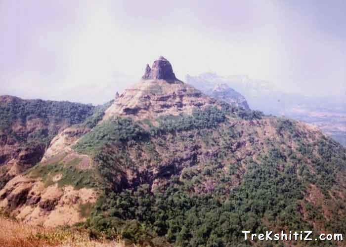
Explore Various Images of the Fort
Fort of Mhasmal.
Maps & Routes
Explore detailed maps and trekking routes to reach the fort
No maps available yet
Browse All MapsIntroduction
On the way from Kalyan to Karjat on the Bombay-Pune rail-route, lies a mountain range. Seen towering high over the rest of the range is a plateau, which is Chanderi. Lying between Badlapur and Vangani railway stations on the Badlapur to Karjat road is a village called Goregaon. From here starts the path that leads us to Chanderi. Chanderi is one amongst illustrious forts like Karnala, Prabalgad, Irshalgad, Manikgad, Peb, Matheran lying in the mountain ranges of Nakhind, Chanderi, Mhasmaal, etc.
Historical Background
Although worth mentioning as the jewel in the crown of forts in the district of Raigad, there is no significant history attached to this fort. Near the caves on the fort are visible some remnants of fortification. This is the only sign to designate Chanderi as a fort. In May 1656, Shivaji Maharaj conquered all territory up to Kalyan-Bhiwandi-Rairi. This was when this fort came under the rule of the Marathas. Lack of development, low water storage areas, absence of significant constructions, limited facilities for people to stay and extremely difficult approach road seem to suggest that rather than a fort, this was possibly a military base.
Points of Interest
A desecrated idol of lord Shiva can be seen inside the cave. Very near to the cave is a reservoir of potable water. However, water is available only till the month of October. The cave can comfortably accommodate 8 to 10 people at a time. Another reservoir of water is situated at the base of the pinnacle near the cave.
The area on the top of the fort is not too much to wander. Due to landslide, reaching the top of the pinnacle has become extremely difficult. To the east of the fort, one can see Matheran, Peb, Prabalgad range, etc. while to the west, can be seen forts like Bhimashankar, Siddhagad, Gorakhgad, Peth, etc.
The area at the foothills of Chanderi is very alluringly enchanting in the monsoons. Many tourists travel here to enjoy the waterfalls.
Trek Duration
⏱️
It takes about 1½ hrs from the village of Chincholi.
Facilities & Amenities
Accommodation
Cave on the fort can accommodate 8 to 10 persons.
Food
One should arrange for own foodstuffs.
Water
Drinking water is generally available in the reservoir till the end of October every year (based on the monsoons).
Best Season to Visit
🌤️ N/A
Additional Information
Rock climbing is necessary to reach the top of the fort.
Other Forts in Matheran
Planning Your Trek?
Pack Smart
Carry essentials, water, and first aid kit
Start Early
Begin your trek early in the morning
Trek in Groups
Always trek with companions for safety
Keep Forts Clean
Do not litter on forts. Do not damage the fort.