Dhakoba
Maps & Routes
Explore detailed maps and trekking routes to reach the fort
No maps available yet
Browse All MapsIntroduction
To the south of Jivdhan & Naneghat there is a mountain range which is abundant with tall hills, extreme vertical rock patches and dense forests. Some of the most prominent forts and pinnacles falling in this range are Kalsubai(5200 ft), Kuland(4800 ft), Ratangad(4200 ft), Ajoba(4600 ft), Harishchandragad(4600 ft), Jivdhan(3800 ft), Durga fort(3900 ft), Siddhagad(3200 ft), Nanacha Angtha or Nana Thumb. Many Ghats or Passes like Naneghat, Darya ghat, Sakurdi ghat, Ahupe ghat, Sadade ghat, Malshej ghat etc fall in this section. Fort Dhakoba is located in one of these hills and the other fort falling in its straight line is Durg. This region is highly secluded and devoid of many basic facilities. Farming and dairy are the main activities of the local population.
Historical Background
Dhakoba fort was mainly built as a watch tower to keep a vigil on the trade routes passing by Vaishakhare to the ghat regions across the mountains. The goods were transported through the creek port of Kalyan.
Points of Interest
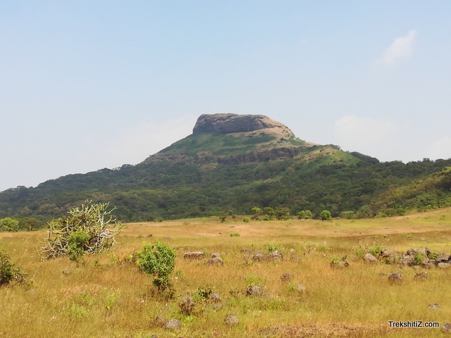
There are no remnants of any fort structure on this fort. from this fort Naneghat, backside of Jivdhan fort, Darya ghat and Konkan region can be seen.
How to Reach
1) Reach Amboli village via Junnar-Aptole. A path from behind the Lord Ganesh temple in the village goes to Darya ghat. After a short trail on this path we come across a diversion to the left. Keep proceeding on this path by having Darya ghat to out right and we come across a cave and a temple of Lord Dwarkeshwar. From here it takes about two hours to reach the base village temple of Goddess Durga. The route to approach the fort from here is a bit difficult and takes about 20 minutes. It takes two hours from Durg fort to reach Dhakoba.
Facilities & Amenities
Accommodation
15 people can be accommodated in the temple at the base village.
Food
Not available
Water
There are water ponds besides the temple.
Best Season to Visit
🌤️ N/A
Additional Information
Dhakoba and Durg forts should be visited jointly.
Other Forts in Bhimashankar
Planning Your Trek?
Pack Smart
Carry essentials, water, and first aid kit
Start Early
Begin your trek early in the morning
Trek in Groups
Always trek with companions for safety
Keep Forts Clean
Do not litter on forts. Do not damage the fort.