Ghangad
Fort Images
Explore Various Images of the Fort
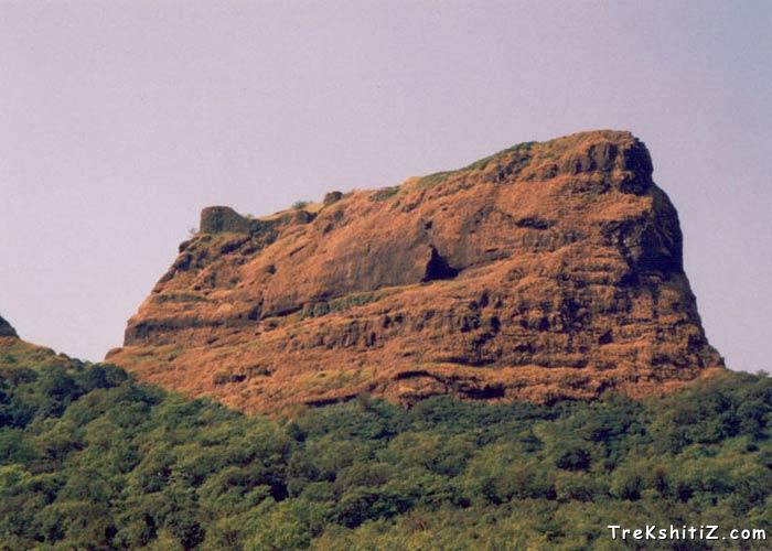
Ghangad From Ekole village.
Maps & Routes
Explore detailed maps and trekking routes to reach the fort
No maps available yet
Browse All MapsIntroduction
Ghangad is situated on western side of Mulshi River, which is called as Korbarase Maval. This fort is surrounded by Korigad, Telbaila and Sudhagad, but still lonely and separated.
Historical Background
There is not much documentation explored about history of the fort. Earlier it was with Koli Samant, then with Adilshah and later with the Marathas
Points of Interest
One can reach the fort by a path from left of the fort. As you enter from the devastated structure of big entrance, you can see some remnants of old palaces along with some water tanks which are now in very bad condition. You can see Sudhagad, Sarasgad and wall of Tailbaila from the fort, also Nandand Ghat, Savvashincha Ghat and Bhorpaychi Nal, which descend to Konkan.
How to Reach
There is only one way from Ekole village which takes you to the fort. Firstly reach Lonavla, and then take a bus to Bhaburde village, which is nearly 40 km away from Lonavla. Then another 20 min. walk from village takes you to the Ekole village. On the way to the fort, you can see a temple of Goddess Garjai. In this temple there is a Shilalekh which says ‘Shree Garaai Maharajachi and Kille Ghangadachi’. From the left side of this temple, is a way to the fort. Further you will reach to a steep patch of 15 ft. It is advisable to carry long rope to climb it, which will directly take you to the fort.
Trek Duration
⏱️ It will take around half an hour from Ekola village to reach the fort.
Facilities & Amenities
Accommodation
There is no accommodation facility on the fort. But around 20 people can be easily accommodated in the Garjai temple.
Water
Water is not available on the fort.
Best Season to Visit
🌤️ September to April
Additional Information
Climbing is necessary.
Planning Your Trek?
Pack Smart
Carry essentials, water, and first aid kit
Start Early
Begin your trek early in the morning
Trek in Groups
Always trek with companions for safety
Keep Forts Clean
Do not litter on forts. Do not damage the fort.