Indragad
Fort Images
Explore Various Images of the Fort
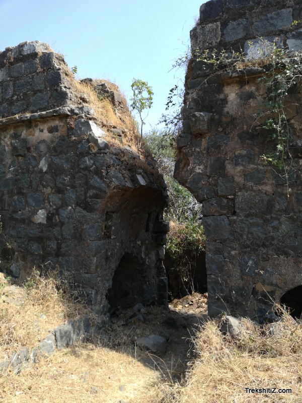
Indragad, Main Entrance gate
Maps & Routes
Explore detailed maps and trekking routes to reach the fort
No maps available yet
Browse All MapsIntroduction
Indragad is on the border of Gujarat and Daman. The main purpose of this fort was to keep an eye on the trade activities on Damanganga river.
Points of Interest
This hill is covered with ample amount of vegetation which gives a relief while ascending the fort. A temple of Goddess Chedu is built adjoining the fort wall and a Sage lives in here. The entrance of the fort is hidden behind a semi-circular wall so that it would be protected from a possible direct attack. There are small narrow windows and porches for the watch keepers in the fort wall. There are remnants of many structures in the fort premise. One can find rooms below the bastion and in the fortified wall.
There is a door to the north and opposite to it also a wall is built. Both the fortified wall and the bastions are in good condition. Darotha and Damanganga river can be seen from the fort. The mountain of the fort is the highest in the region which enables us to view a vast area around it.
How to Reach
The base village of the fort, Pali Karambeli is 11 kms from Vapi. In this village there is a temple of Laxmi Narayan. From this temple an unpaved road leads to the fort in 30 minutes. From Daman the base village is 6 kms.
Facilities & Amenities
Accommodation
Nil
Food
Nil
Water
Nil
Best Season to Visit
🌤️ July to March
Planning Your Trek?
Pack Smart
Carry essentials, water, and first aid kit
Start Early
Begin your trek early in the morning
Trek in Groups
Always trek with companions for safety
Keep Forts Clean
Do not litter on forts. Do not damage the fort.