Lingana
Fort Images
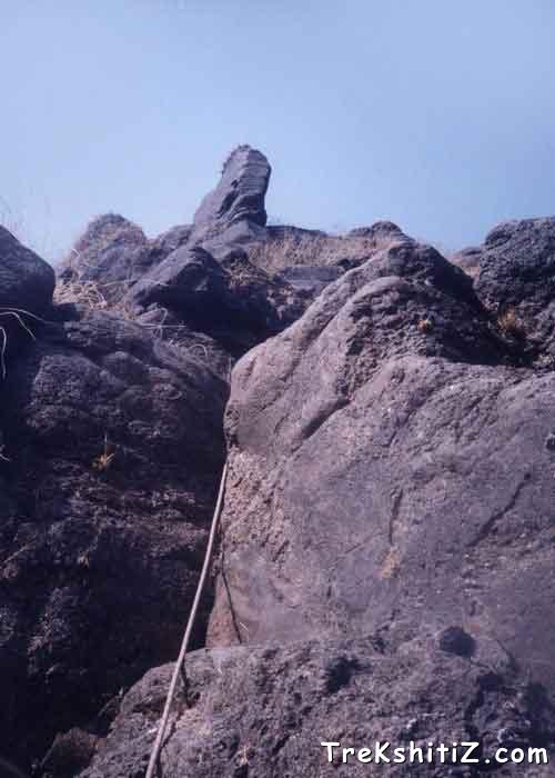
Explore Various Images of the Fort
Lingana Pinnacle
Maps & Routes
Explore detailed maps and trekking routes to reach the fort
No maps available yet
Browse All MapsIntroduction
The pinnacle of Lingana had always been a matter of attraction in my imagination. The British destroyed every way to the fort in early 19th century and the fort was considered inaccessible till 1981, until a group of hikers climbed the pinnacle of Lingana. The fort played an important role as a protection to Raigad, the capital of Maratha Empire. Due to its invulnerability, the prisoners convicted of dangerous crimes were kept here.
Historical Background
The history of Lingana is not as glorious as the important ones, but still we get many a reference that put a light on it. These references can be concluded as follows:
The fort of Lingana is situated to the northeast of Raigad. It is about 2969 feet high. The distance to be covered to reach to the fort is about 4 and half miles. The ramparts have ruined. The only remnants are the storehouse and some cisterns.
Shivaji built it with Raigad after he defeated Chandrarao More. According to the treaty of Purandar Raigad and Lingana were retained by Shivaji Maharaj.
The goddesses worshipped here were Shree Janani and Somjai.
The fort was maintained along with Raigad. The money was provided from treasury of Raigad. It was maintained and looked after till 1786. Finally, in 1818, the British captured the fort and destroyed it so that no one could capture it back and stay on it. Thereafter the plight of this great monument has become sad. Today it is a great attraction for rock-climbers, but its history should be revealed to more and more people.
Points of Interest
The fort is not a very big fort. However the soil here is eroded at much faster rate as all the existing grass that grows on the mountain slopes is burnt down. Due to this the soil loses its grip and is washed away. Hence we find bit difficult to climb and walk on the top of the fort. In the root of the pinnacle is a cave where 50 people can stay. This is supposed to be a storehouse for grains. It faces the western side, to the fort of Raigad. As the dawn arises, we can have a beautiful glimpse of Raigad. Near the cave is a small memorial of a mountaineer Santosh Gujar. He met an accident while descending Lingana in 1979 and passed away.
As we go ahead of the cave, we come across some cisterns that contain potable water. Ahead of this are few broken steps, which lead us to remnants of old constructions. Here there are more cisterns.
As we traverse along the periphery of the pinnacle, we have to walk all the way on slippery route, and its necessary to carry a rope. As we reach the northern end, we have to climb some vertical rock patches. After ascending for about 150 ft., we come across broken fortification. At this height there is a cistern that is the only spot for water while going on the top. Here we can see the young vultures practicing the act of flying. Their cries fill the valley with some mystery. Then one has to ascend some 200 ft more to reach the top of the pinnacle. From here we can view Nagaarkhana and Jagdishwar temple of Raigad. We can also see Rajgad and Torna on the east. Here we feel to be on the top of the world.
Right at the base of the pinnacle, above the cave are some remnants. To reach to them is quite difficult. We can see it on the way to the fort.
How to Reach
One has to reach Mahad city. S.T. buses ply regularly from Kalyan, thane, Mumbai, Pune to Mahad. One can also board the passenger train from Diva station at 6:00 am. From Mahad bus depot, two buses go to the village of Paane, which is at the base of the fort. First bus leaves at 11:00 am and the other one is at 4 pm. From here, we can reach the village on the upper plateau, which is called Lingana machi. From here a walk of 1 hr on slippery way leads to the base of the pinnacle.
Trekkers going from Rajgad or Torna to Raigad come through the valley called Borhatyachi Naal, which lies between the mountain of Lingana and the mountain of Raylingi. We come from the northern end of the fort to Lingana machi.
Trek Duration
⏱️ 1-½ hours from Lingana Machi.
Facilities & Amenities
Accommodation
The cave on the fort is the best place to stay. It can accommodate 30-40 people
Food
One has to carry the foodstuffs there.
Water
Water is available in the cistern ahead of the cave, on the northwest side of the fort.
Best Season to Visit
🌤️ N/A
Nearby Villages
Linganamachi,Pane
Other Forts in Raigad
Planning Your Trek?
Pack Smart
Carry essentials, water, and first aid kit
Start Early
Begin your trek early in the morning
Trek in Groups
Always trek with companions for safety
Keep Forts Clean
Do not litter on forts. Do not damage the fort.