Moti Daman Fort
Fort Images
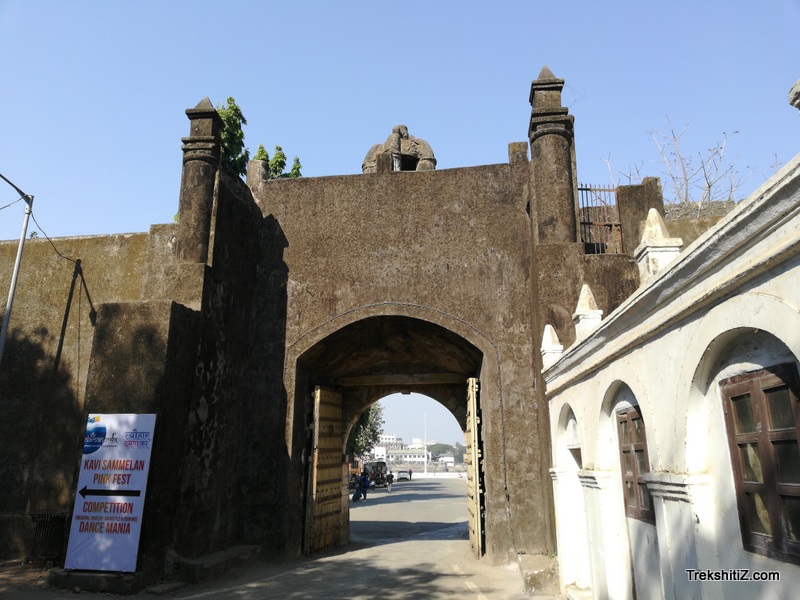
Explore Various Images of the Fort
Moti Daman Fort
Maps & Routes
Explore detailed maps and trekking routes to reach the fort
No maps available yet
Browse All MapsIntroduction
This fort is located on the Southern bank of Damanganga river. Moti Daman as the name suggests is the bigger fort when compared to Nani Daman. Portuguese built this fort in the 16th century and in 1961 it came under the province of Independent India. The other fort Nani Daman is on the Northern bank of the river.
Points of Interest
This fort and its parts – the fortification wall, its bastions and the trench are still in good condition. As of today, its premises are occupied by the offices of the State Government. There is also a light house in the fort. We can find 10 Pentagonal bastions built in Portuguese style and also capsule bastions on the fortification wall which are a typical feature of the Portuguese. There are two entrance to the fort, north and south with scriptures and coat of arms engraved on the doors. The church of Bom Jesus has been built in the fort which has beautiful carvings on wood. The bridge across the Damanganga river can be accessed to reach Nani Daman fort.
How to Reach
Daman is 12 kms from Vapi and can be accessed easily through multiple means of transport.
Facilities & Amenities
Accommodation
Nil
Food
Nil
Water
Nil
Best Season to Visit
🌤️ July to March
Planning Your Trek?
Pack Smart
Carry essentials, water, and first aid kit
Start Early
Begin your trek early in the morning
Trek in Groups
Always trek with companions for safety
Keep Forts Clean
Do not litter on forts. Do not damage the fort.