Parnera Fort
Fort Images
Explore Various Images of the Fort
Parnera Fort, Main Entrance gate
Maps & Routes
Explore detailed maps and trekking routes to reach the fort
No maps available yet
Browse All MapsIntroduction
Reach Atul town on the Vapi-Surat railway route by a passenger train from Vapi. The hill of Parnera fort is visible from Atul station and is at 2.5 kms from here. Auto rickshaws are available to reach the base of the fort. If coming by road Vapi can be reached on the Mumbai-Ahmedabad highway. At the base, there is a sign board which says the land belongs to Atul Organisation. There are 3 temples on the fort which makes this place frequently visited by the villagers.
Historical Background
It is not known who built the fort on this hill. But the structure of the water tanks on the fort reveal it might be from the Chalukya era. In the 15th century this fort was under the control of the King of Ramnagar. Mohammed Begada won this fort and during his later times it was under the control of the Pendharis. Twice in 1551, the Portuguese of Daman attacked this fort after which it got abandoned. In 1676, Chhatrapati Shivaji Maharaj refurbished this fort and it remained under the Maratha empire until 1780. After the Marathas, the fort was taken over by Wels.
Points of Interest
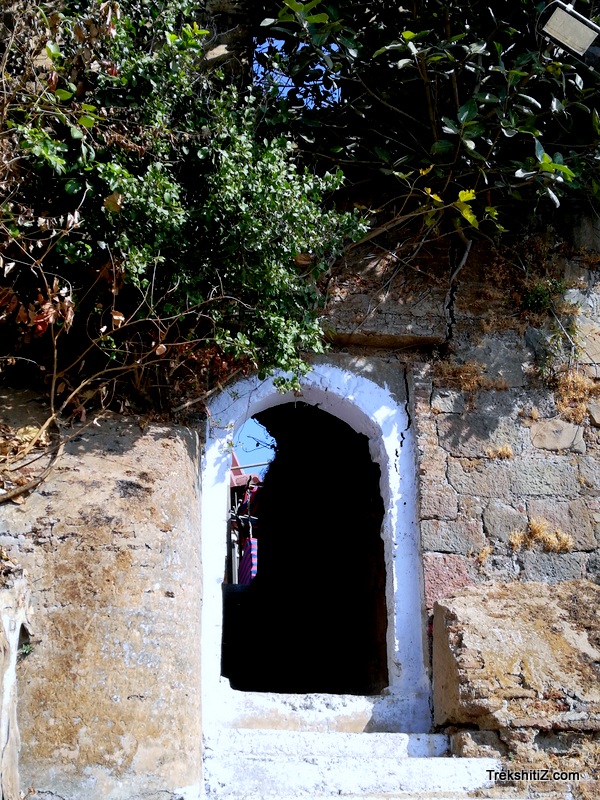
Proper stairways are built for access to the fort and trees are planted and conserved on the fort slope. It takes about 30 minutes to reach the fortified wall on the fort top. The wall has been partly demolished to make way for entrance to the fort. Instead of taking this entrance, take the path to the right which circumvents the fort wall to reach a 6 ft high entrance door. This doorway is hidden between bastions. After we enter, 10 stairs take us to the fort top. There is a temple of Goddess Kalika here and a couple of small shops. The fort is spread in South-North direction. The two parts of the fort are its Summit and Citadel which are protected by fortified wall and bastions.
Adjacent to the temple there are steps which lead to the citadel of the fort. The entrance of the citadel no longer exists and there are many remnants of structures on the citadel. The extensive stretch of Paar river can be seen from the top. As this is the only fort in the region it had a very important role in keeping a watch across the territory.
We descend at the Goddess Chandika temple after visiting the structures atop the citadel. There is also a Lord Hanuman temple here. Moving ahead from the temple we come across a tomb of Chandpir baba to the left. There is a second doorway here and a path to descend. As we move further towards the stairs which lead to Rameshwar temple, there are three canons lying on the ground. Atul Corporation the Trust assigned to the fort have almost concretised the entire fort but failed to take proper care of the canons, making it a waste of money and resource. Rameshwar temple is to the north side of the fort. After visiting Rameshwar temple head back towards Chandika mata temple where we find 5 water tanks carved in rock to the left. Besides these tanks there is bridge built of concrete which leads to the entrance of the fort.
Trek Duration
⏱️ 30 minutes from base
Facilities & Amenities
Accommodation
Nil
Food
Nil
Water
Available
Best Season to Visit
🌤️ July to March
Planning Your Trek?
Pack Smart
Carry essentials, water, and first aid kit
Start Early
Begin your trek early in the morning
Trek in Groups
Always trek with companions for safety
Keep Forts Clean
Do not litter on forts. Do not damage the fort.