Santoshgad
Fort Images
Explore Various Images of the Fort
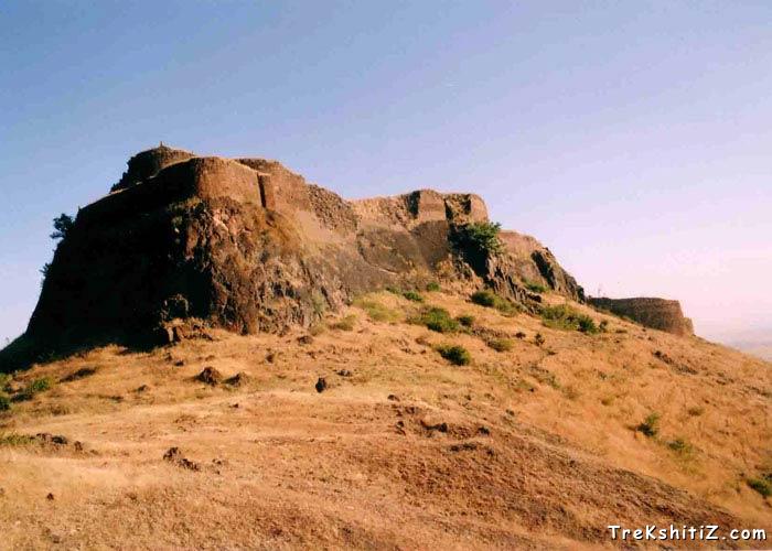
Backside View of Santoshgad
Introduction
Sahyadri range is mainly divided into three parts: “Shambhu Mahadev” Range, “Bamnoli” Range and “Mhasoba” Range. The forts Santoshgad, Varugad, Mahimangad and Vardhangad are a part of “Mhasoba” range and in ‘Maan’ district. It takes two days to see visit all four forts. Santoshgad is also called as ‘Fort of Tathawada’, since the base village is called by that name.
Points of Interest
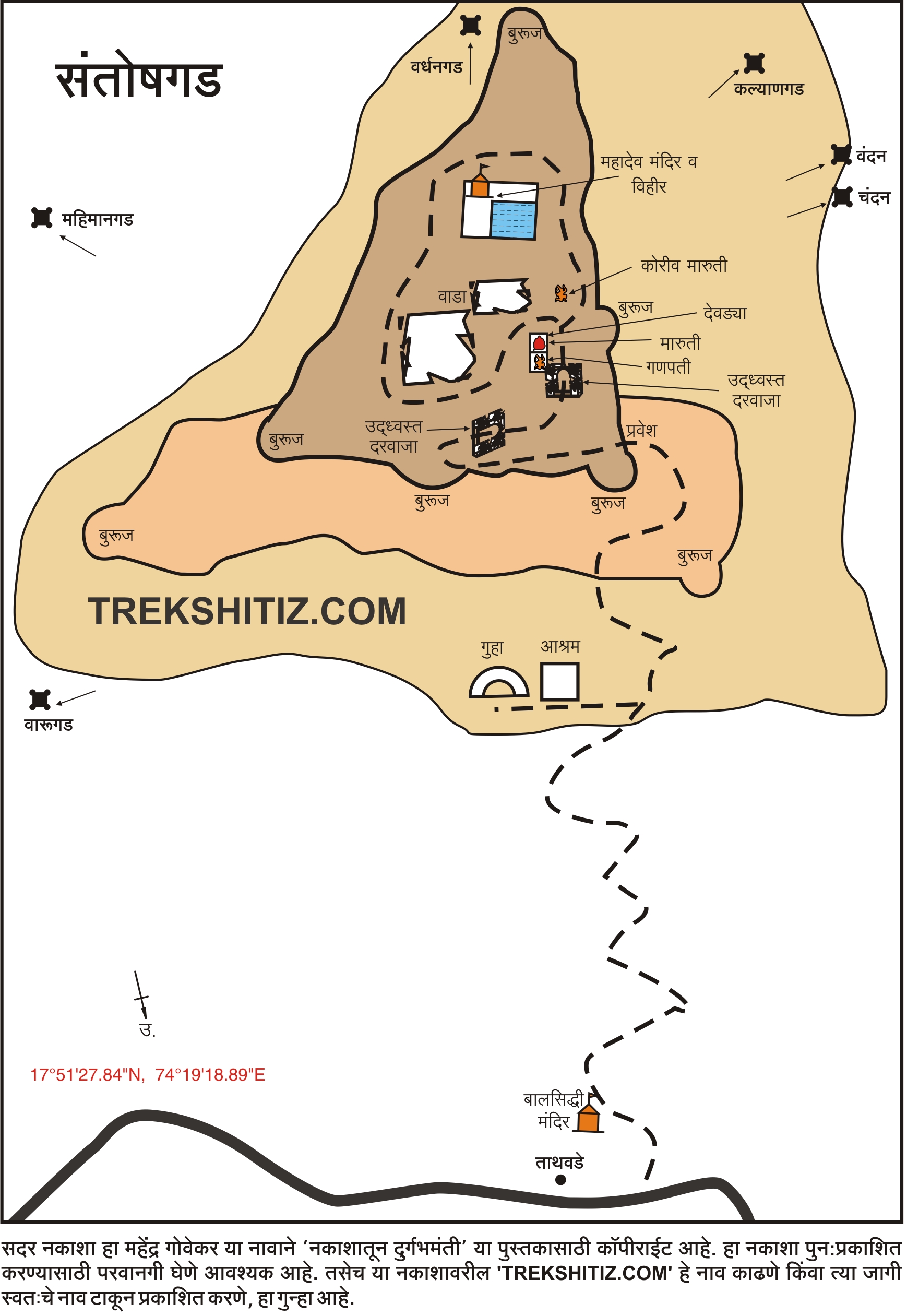
Santoshgad is divided into three parts. First part of the fort is the protective (defensive) fortification, second part is the flat portion on the mountain and the topmost part is the “Balekilla” or the top citadel. There is a ‘Math’ (cloister/ monastery) on the way to Santoshgad. Besides this monastery is a cave with water storage tank. Also, there is a statue of “Valmiki Rishi”. There is an entrance on the upper side of the monastery, for which we need to go around it. The path to the left side of the monastery goes along the fort walls and takes us to the main entrance. There is a small temple on this way.
There are hardly any remnants of the main entrance, but the porches (meant for guards) are still intact. After entering through this door, a tank called ‘Hanuman Take’ can be seen. Behind this tank are many dilapidated structures and some old warehouses. Behind these buildings is a huge water tank with steps carved into walls of the tank for descending. There is a Shiva temple inside.
Though the remains on the fort are diminishing, the outer walls and Bastions are in a good shape. It takes couple of hours to see the complete fort. The fort was used to keep watch on the surrounding area. To the west side of the fort is the mountain range of “Molghaat” where the mountain of Seetamai and fort Varugad are situated.
How to Reach
Tathawada village is situated 19 km Southwest of Phaltan. Phaltan. There are Maharashtra State Transport buses available for every half an hour from Phaltan to Tathawada. We can get down at Tathawada village, by the Satara-Phaltan bus which passes through PuseGaon-MolaGhat. The distance between PuseGaon and Tathawada is about 23 kms. There is a proper trail from Tathawada to the fort. It takes half an hour by this route to reach to the fort. There is a restored temple of ‘BalSiddha’ in Tathawada village, which was restored in 1762. Private vehicles can help us see all the 4 forts in this range 2 days. Pune to Phaltan driving distance is about 2 and half hours.
Trek Duration
⏱️ Approximately half an hour from the base village
Facilities & Amenities
Accommodation
None
Food
Packed food advised
Water
There is water tank on the fort, which has potable water.
Best Season to Visit
🌤️ All year round
Other Forts in Mhasoba, Satara
Planning Your Trek?
Pack Smart
Carry essentials, water, and first aid kit
Start Early
Begin your trek early in the morning
Trek in Groups
Always trek with companions for safety
Keep Forts Clean
Do not litter on forts. Do not damage the fort.