Vasota
Fort Images
Explore Various Images of the Fort
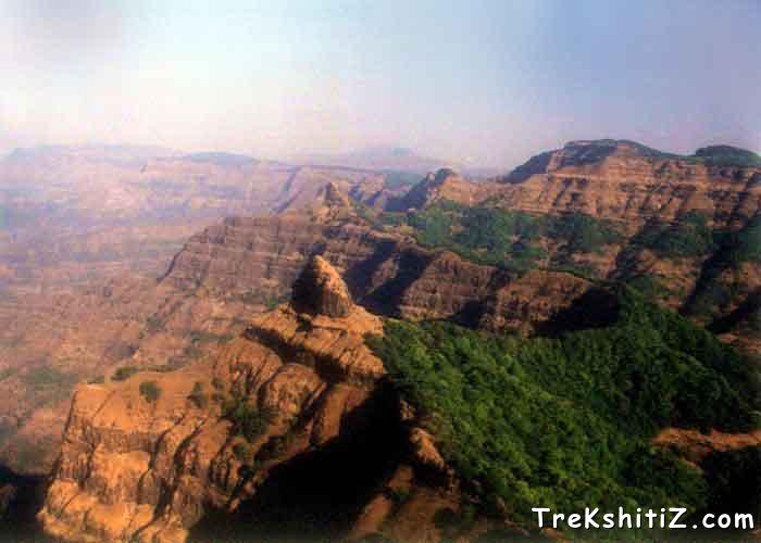
Pinnacle Of Nageshwar
Introduction
Situated in dense forests surrounded by river Koyna is the fort of Vasota, which according to the ‘Dnyaneshwari’ means a resting place. This fort is also known by the name of Vyaghragad.
Historical Background
We have to go back to the times of Sage Vasishtha to know how exactly old is the fort. It’s believed that a disciple of Vasishtha, a sage by the name Agasti, came to reside on a mountain on the banks of river Koyana. He named the mountain after his mentor. Later the mountain was fortified and converted into a military station. In the course of time, fort Vasishtha was pronounced as ‘Vasota’.
This fort is believed to belong to the Shilahar dynasty era, and probably named Vasota due to the name Vasantgad given to it during that era. According to ancient scriptures Shivaji Maharaj took Vasota after his successful raid on Javli region. But it is untrue. Shivaji Maharaj took Javli and other forts in the Konkan region but Vasota eluded him. When Shivaji Maharaj was trapped on Panhalgad he dispatched a battalion from his main army and won Vasota on June 6, 1660. Later in 1679, 26,000 rupees were found on the fort. Among the prisoners caught in 1661 in Rajapur, Faren and Samuel were kept imprisoned on the fort.
Later in 1706, Tai Telini brought the fort under her control. The very next year Peshwa Senapati Bapu Gokhale fought with her. After 8-10 months of intense battle, Bapu Nadkarni conquered the fort.
Points of Interest
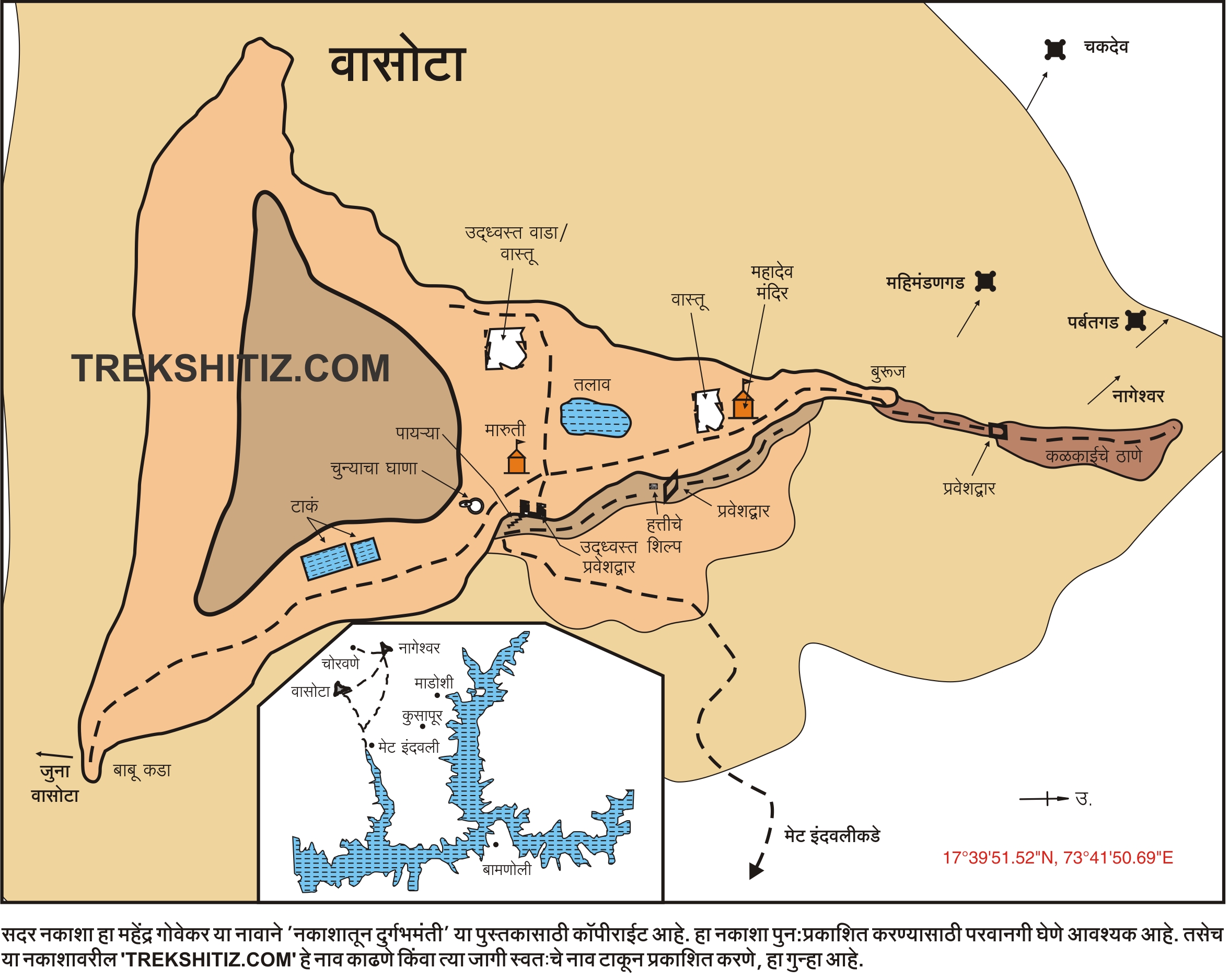
There are two entrances to the fort Vasota. The first one lies in a dilapidated state. We enter the fort through the second one.
On entering the fort we see a Hanuman temple, now devoid of a roof. Three ways go ahead this temple. The path straight ahead takes us to the remnants of the fort. The one on the left takes us at ‘Kalkaiche Thane’. On the way is a Mahadeo temple which can accommodate 2-3 people. Moving along the path we arrive at ‘Machi’. The view of the surrounding region is simply spectacular.
The path on the left of the Maruti temple takes us to the joint water cisterns. Water in these cisterns is potable. The way proceeds to a fascinating cliff named Babukada, shaped like the letter ‘U’ that reminds us of Konkan Kada of Harishchandragad. The mountain seen in front of Babukada is the Old Vasota.
How to Reach
There are 2 main ways to reach the fort, one via Nageshwar and the one directly to Vasota.
Trek Duration
⏱️ via Kusapur : 4 hours
Facilities & Amenities
Accommodation
1.Mahadeo Mandir can accommodate 2-3 people.
2.A plateau near the joint water cisterns can also be used as camping ground.
3.Nageshwar cave can accommodate 20-25 people easily.
Food
One should arrange for self.
Water
The way to the right of the stairways to Nageshwar cave takes us to a well, water in which can be used for consumption. Even in summer this well does not dry out. Water is available in sufficient quantity on Vasota.
Best Season to Visit
🌤️ N/A
Additional Information
Proper precaution should be taken against leach while visiting Vasota during rains.
Nearby Villages
Kusapur,Choravane
Other Forts in Mahabaleshwar
Planning Your Trek?
Pack Smart
Carry essentials, water, and first aid kit
Start Early
Begin your trek early in the morning
Trek in Groups
Always trek with companions for safety
Keep Forts Clean
Do not litter on forts. Do not damage the fort.