Kokandiva
Maps & Routes
Explore detailed maps and trekking routes to reach the fort
No maps available yet
Browse All MapsIntroduction
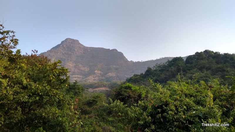
Sahyadri; range of many huge mountains, hills, pinnacles, and forts. One of the best forts in this range is fort Raigad. Raigad is surrounded by many mountains and hence, one does not get an easy view of Raigad. Raigad was the capital Chattrapati Shivaji Maharaj. Considering this, some of the surrounding mountains / hills were then fortified to keep a watch on Raigad. Kokandiva is one such fort. Located towards north of Raigad, this fort was built to keep a watch on the routes near Raigad and Kavlyaghaat.
Points of Interest
After ascending for half an hour one comes across a cave. Around the cave, there are four water cisterns. The water cistern nearest to the cave, is easily accessible. This Water cistern does not have proper steps to go and collect water. However, there is a hole of approximately a foot diameter, which enables only one person to take out water from the cistern at a time. From the cave, there is a path which takes us to the top of the fort. There is a rock patch of approximately 10 feet to be climbed. In the monsoon, this rock patch gets slippery and it is strongly adviced to carry a rope while ascending and descending. After climbing this this rock patch one has to take a path which leads to the top of the fort. There is scree on this path and hence, caution is advised. From the top of the fort Kokandiva one can see fort Raigad towards south, Lingana towards south-east and fort Torna towards east.
How to Reach
There are two ways to reach Kokandiva:
1. Via Garjaiwadi
2. Via Sandoshi
1. Via Garjaiwadi
This is the easiest route. Reach Ghol via Pune-Panshet-Dapsar-Ghol (approximately 75 km from Pune). From Ghol, take a right (route going to east) towards Garjaiwadi. In almost an hour one can reach Garjaiwadi (approximately 2/3 km from Ghol). From Garjaiwadi take a route towards right. Ahead, there is a small descend on this path which takes us near bunch of trees. From here there is a 10 minute walk which leads to a plateau. From here Kokandiva is visible. From this plateau, there is a path which goes up to the cave leading to the top of the fort.
2. Via Sandoshi
Reach Mahad via Mumbai - Panvel - Mahad. Reach Sandoshi from Mahad via Mahad-Pachad-Sandoshi (approximately 32 km). Autos, 6 seaters and S.T. buses are available on this route. After ascending Kavlyaghaat from Sandoshi, in approximately 2 hours, there is a plateau. From here one route goes to Garjai village and other to the fort.
Trek Duration
⏱️ 2 hours from Ghol. 3 hours from Sandoshi.
Facilities & Amenities
Accommodation
7-8 People can stay in the cave on the fort. 10 people can be accommodated in the temple in Garjai village.
Food
Food arrangements have to be made by our own.
Water
Water cistern near the cave has potable water.
Best Season to Visit
🌤️ N/A
Additional Information
1. During the monsoons, the route from the cave to the top of the fort becomes slippery. Hence, extreme caution is to be exercised during this period while ascending. It is advisable to carry a small rope.
2. Water at Garjawadi is not potable. Hence, one needs carry enough stock of water.
Other Forts in Raigad
Planning Your Trek?
Pack Smart
Carry essentials, water, and first aid kit
Start Early
Begin your trek early in the morning
Trek in Groups
Always trek with companions for safety
Keep Forts Clean
Do not litter on forts. Do not damage the fort.