Markandeya
Maps & Routes
Explore detailed maps and trekking routes to reach the fort
No maps available yet
Browse All MapsIntroduction
The mountain range starting from Saptashrungi hosts many forts viz; Saptashrungigad, Markandeya, Ravlya-Javlya, Dhodap etc. Markandeya stands opposite to Saptashrungi hill. The mountain and the fort derives its names after Sage Markandeya who had stayed here.
Historical Background
Aurangzeb had ordered Alivardi Khan to gain control over the forts of Nashik province. In 1639, Alivardi Khan won all the forts mentioned above and the inscription mentioning same can be seen on Indrai fort which is in Persian text. Shivaji Maharaj won the forts of Nashik in the battle of Wani-Dindori which included Markandeya. The Mughals regained control over these forts after the death of Shivaji Maharaj.
Points of Interest
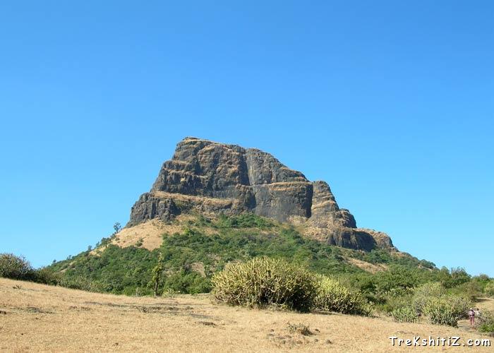
The pass/valley between Markandeya and Ravlya-Javlya forts is known as Mulanbari. The ascend to Markandeya starts from here where we come to the open part of the fort first and further rock cut steps lead to the citadel. Towards the left side on this route, beneath, there are two caves known as “Dhyaan Guha” (literally means caves for meditation). Moving upwards one can see the remains of bastions and fortification wall. Where these steps end, we can see Saptashrungi gad and from here towards left, rock cut path takes us to the citadel. Here we first come across a rock cut water tank named “Kamandalu tirth” which has water throughout the year and further there are three water tanks in a row and a dried tank alongside. There is a temple of Lord Markandeshwar on the summit which has an idol of Sage Markandeya and a Shivling. Saptashrungi gad, Dhodap, Ravlya-Javlya can be seen from the top.
How to Reach
Wani is 40 kms from Nashik on the Nashik-Saputara highway. 9 kms from Wani on Wani-Kalwan road there is a village named Babapur which is the base village of the fort. There are two ways to reach the fort. One can reach Mulane pass by a vehicle/ST bus which is 2 kms from the base village. Moving towards Kalvan village from here the road to the right leads to Ravlya-Javlya while the one to the left to Markandeya. Another route is via the valley between Saptashrungi gad and Markandeya which has a steep ascend.
Trek Duration
⏱️ 1 hour from Mulanbari/Mulane pass.
Facilities & Amenities
Accommodation
Nil
Food
Nil
Water
Throughout the year
Best Season to Visit
🌤️ N/A
Other Forts in Ajanta Satmaal
Planning Your Trek?
Pack Smart
Carry essentials, water, and first aid kit
Start Early
Begin your trek early in the morning
Trek in Groups
Always trek with companions for safety
Keep Forts Clean
Do not litter on forts. Do not damage the fort.