Raikot
Introduction
This fort in the Kondaibari Ghat was built to keep an eye on the Surat-Burhanpur trade route.
Historical Background
Raikot fort was built by King Ahir and the main purpose of this fort was to serve as a watch tower for the trade routes. Considering the size and spread of the fort the existence of a garrison on the fort rules out. Also hardly any information can be obtained from the historical records.
Points of Interest
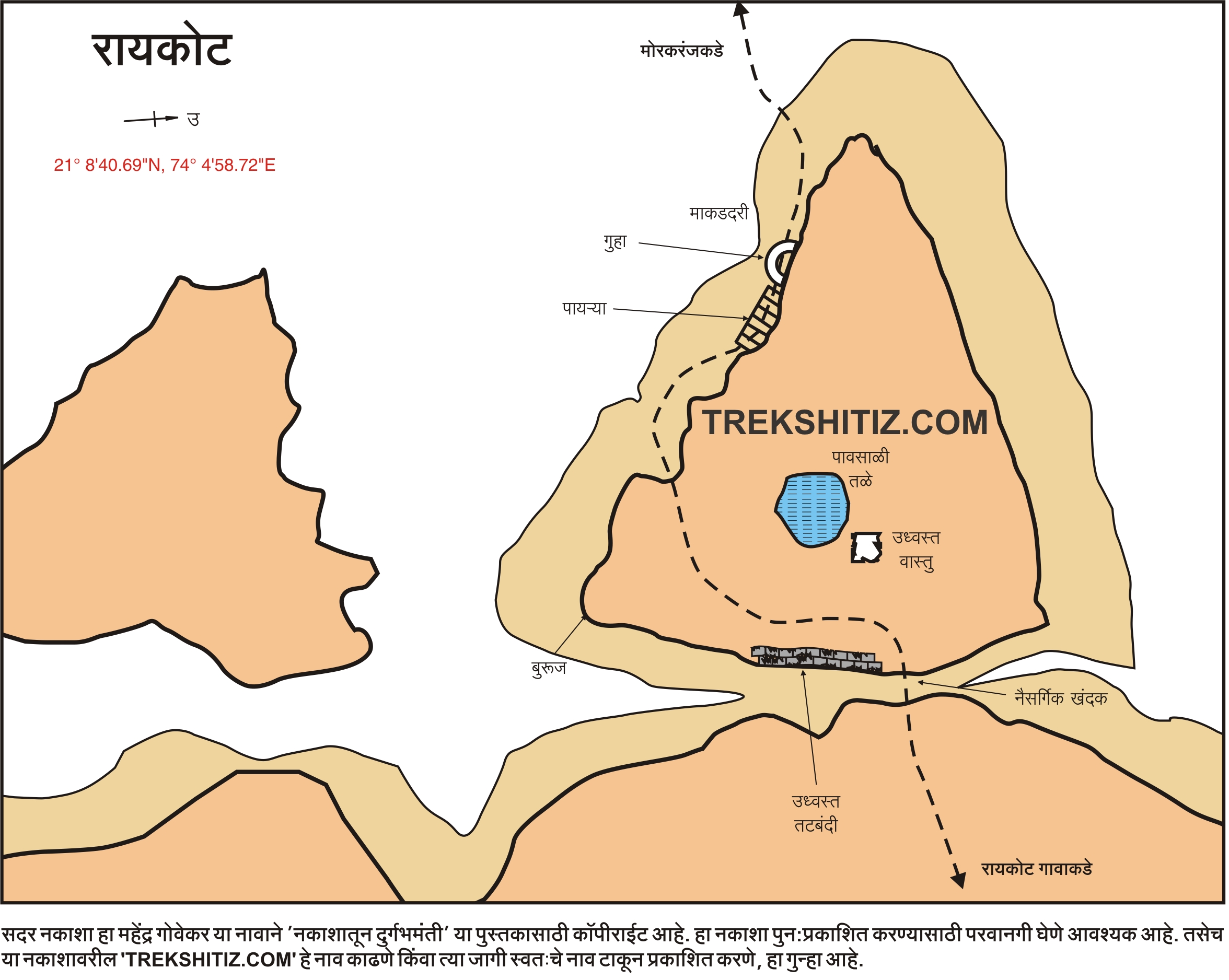
Remnants of the fort wall can be seen on a trench between two hills on the way to the fort from Raikot village. This fort is now being utilized as a farm land which is the main reason for its ruins. There is a lake and a bastion on the fort.
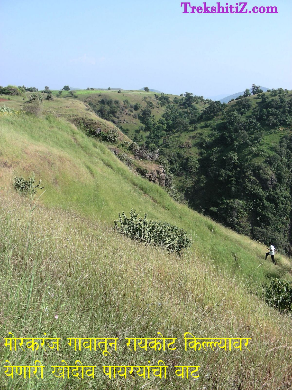
The path from Morkaranj village to the fort has stairs built in rock. There is a cave (10 ft * 20 ft in size) near the stairways but it is not recommended for a stay. The beautiful and steep valley which surrounds the fort from three sides is called Makad-dari.
How to Reach
Kondaibari ghat is on the Dhule - Surat route. Kondaibari village is at the beginning of the ghat and Morkaranj village is at the end. Raikot fort can be reached from both these villages.
l) Kondaibari route:-
Kondaibari village is 70 kms from Dhule on the Dhule - Surat route. 3 kms further from this village, on the Nandurbar road, take the left diversion to Raikot village. One passes by Navagaon (4 kms) - Lagadvaad (2 kms) and finally to Raikot (2 kms). The road from Hanuman temple outside the village ends at a small path which further takes us to a trench. One reaches the fort after climbing this trench. As the surrounding area of the fort is located at a height well above sea level, the further ascend to the fort becomes quite easy.
2) Morkaranj route:-
A small path from Morkaranj village via Makad-dari valley and then stairs built in rock on the upper side of the fort leads us to the fort entrance.
Trek Duration
⏱️
From Raikot: 1 hr
From Morkaranj: 2 hrs
Facilities & Amenities
Accommodation
Nil
Food
NIl
Water
Nil
Best Season to Visit
🌤️ N/A
Additional Information
1) After the monsoon season, the fort and the surrounding area turns into a paradise for butterflies. Also the scenic beauty from Kondaibari to Raikot is eye pleasing.
2) From Dhule, Forts of Bhamer and Raikot can be visited in a single day.
Planning Your Trek?
Pack Smart
Carry essentials, water, and first aid kit
Start Early
Begin your trek early in the morning
Trek in Groups
Always trek with companions for safety
Keep Forts Clean
Do not litter on forts. Do not damage the fort.