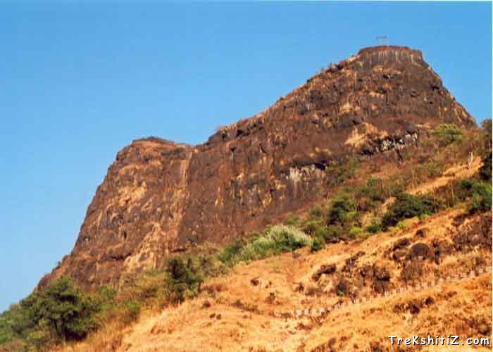
Chambhargad
Maps & Routes
Explore detailed maps and trekking routes to reach the fort
No maps available yet
Browse All MapsIntroduction
There are many forts in the mountain range nearby Raigad, which mainly includes Lingana, Kaldurg, Songad and Chambhargad. These forts were basically built for keeping an eye on the nearby area. Chambhargad is very near to Mahad.
Points of Interest
This fort has a relatively smaller plateau. We can see some old structures along with some water tanks. From the structures of the tanks it can be predicted that this fort is relatively old. You can see the entire fort hardly in half an hour.
How to Reach
Firstly you have to reach to Mahad. Then you have to cross the Mahad-Poladpur Highway and reach the base village Chambharkhed. It will merely take 20 mins from Mahad S.T. depot. From the Khind or the valley you will reach the top of the fort within an hour.
Trek Duration
⏱️ Merely one hour to reach the fort top from Mahad.
Facilities & Amenities
Accommodation
There is no accommodation facility on the fort.
Food
There is no food facility available on the fort.
Water
Though there are water tanks on the fort, water is not suitable for drinking. Hence it is always advisable to take water along with you.
Best Season to Visit
🌤️ N/A
Other Forts in Raigad
Planning Your Trek?
Pack Smart
Carry essentials, water, and first aid kit
Start Early
Begin your trek early in the morning
Trek in Groups
Always trek with companions for safety
Keep Forts Clean
Do not litter on forts. Do not damage the fort.