Ghodbunder Fort
Fort Images
Explore Various Images of the Fort
Ghodbunder Fort
Maps & Routes
Explore detailed maps and trekking routes to reach the fort
No maps available yet
Browse All MapsIntroduction
Kalyan in Thane district has been a prominent harbour from ancient times. Other ports present on this sea route were Nagla Bunder and Ghodbunder. The forts of Nagla Bunder, Ghodbunder and Gomukh were built to guard these ports.
Near the Ulhas creek, an extension of the mountain is horse shaped; hence the port built here was called Ghodbunder (“Ghoda” means Horse).
Historical Background
Ghodbunder fort was under the Portuguese control in 1672. Shivaji Maharaj tried to capture the fort but did not succeed. The Marathas took over the fort in 1737 during campaign of Vasai fort. References say that 250 Portuguese were killed and 7 ships were captured by Marathas. It was during this campaign the forts of Nagla Bunder, Ghodbunder and Dharavi were captured. The British took over this fort in 1818.
Points of Interest
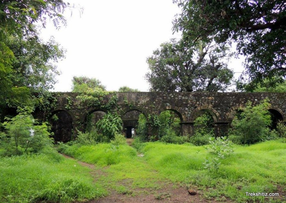
We enter the fort through broken entrance, and see a mansion in front with many rooms. There is a hall with tall walls on the top of the fort. There is a bastion ahead. On climbing this bastion, we see a marvellous door which has no locks and hinges. It can be opened by sliding it vertically through slits in the walls.
From the top of the bastion we can see the surrounding region and Ulhas creek.
How to Reach
Ghodbunder village is present on the Thane-Borivli route via Ghodbunder road. It takes around 45 minutes to reach the fort from the village.
Facilities & Amenities
Best Season to Visit
🌤️ N/A
Other Forts in None
Planning Your Trek?
Pack Smart
Carry essentials, water, and first aid kit
Start Early
Begin your trek early in the morning
Trek in Groups
Always trek with companions for safety
Keep Forts Clean
Do not litter on forts. Do not damage the fort.