Indrai
Introduction
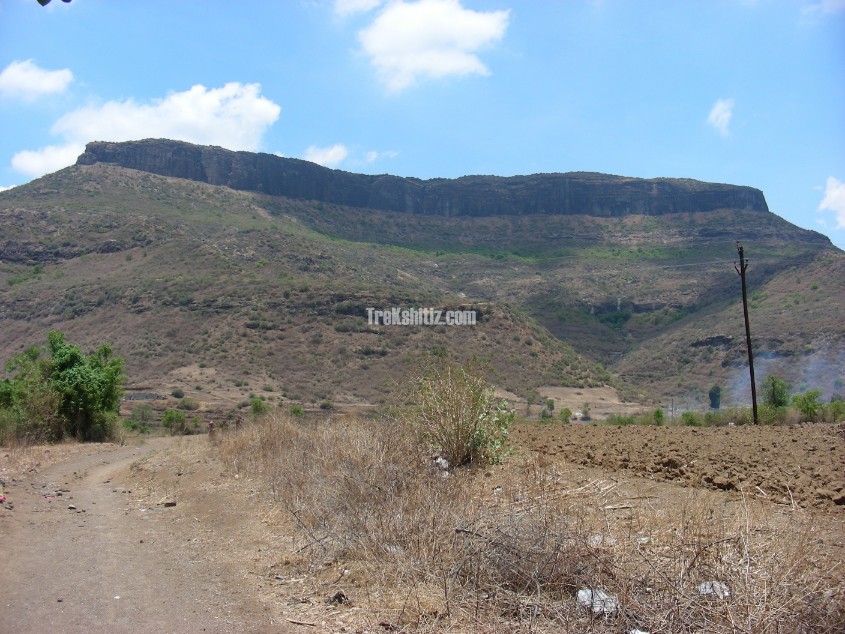
One of the mountain ranges of Sahyadri starts from Surgana in Nasik, and ends at Chandvad. This is called Ajanta Satmaal. Amongst the various forts in this range, Rajdher, Indrai, Koldher and Chandvad lie in the Chandvad taluka.
Points of Interest
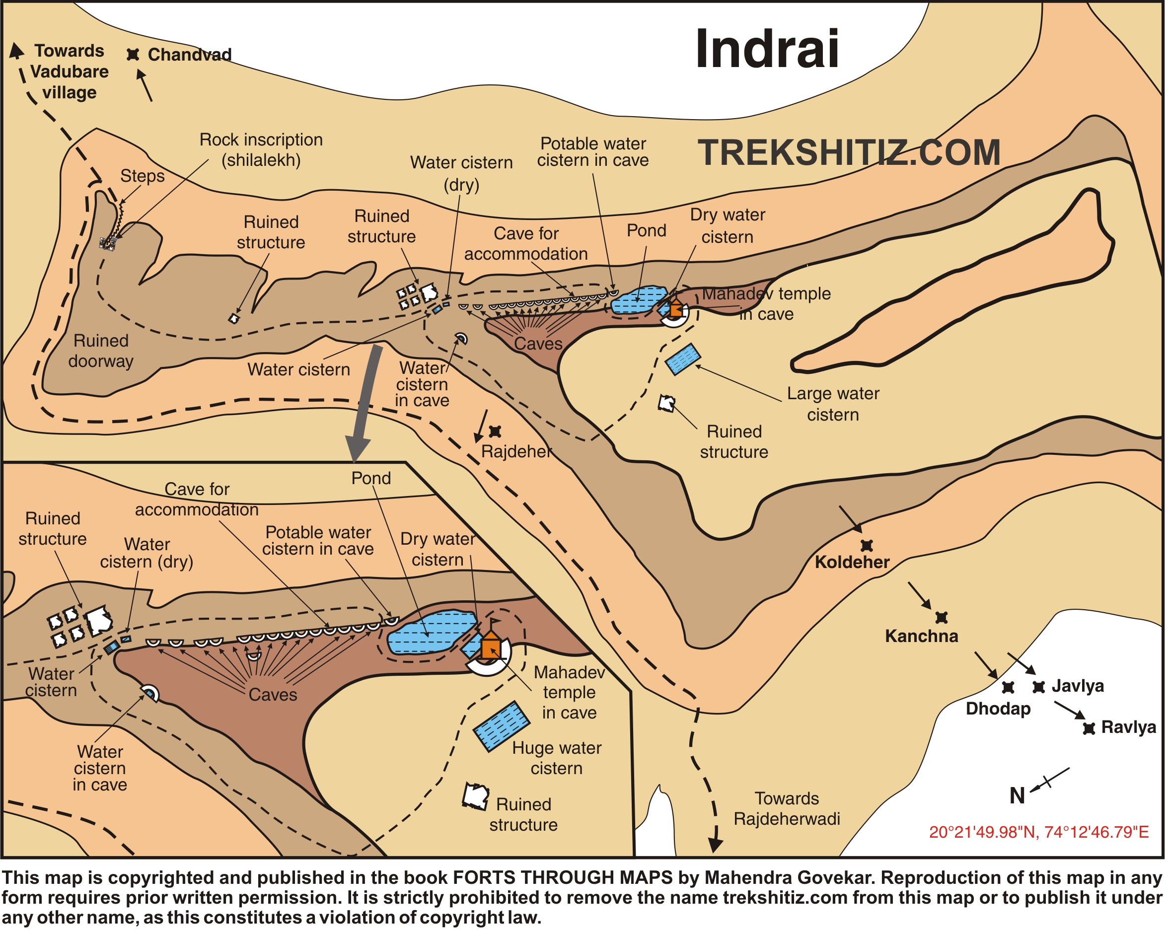
There are 2 ways to the fort, which lead to the base of the final summit. Here we find 2 caves and a water tank. There are around 150 rock cut steps to the top. After ascending the steps to the fort, we can see the remnants of the entrance and there is a stone inscription on the left side of the entrance. The mountain top is extensive. We need to go to the left side after the entrance. Here we come across 3 ways. The rightmost way leads to few rock-cut caves. The middle one takes to the temple of Lord Shiva on the fort. The leftmost way leads to the mountain face where we find around 18-20 caves. Some caves are suitable for staying and here a water cistern is also present.
We can see the forts of Rajdher, Chandvad, Koldher, Dhodap, Ikhara from the top.
How to Reach
There are 2 ways to the fort, which lead to the base of the final summit.
Facilities & Amenities
Accommodation
Caves on the fort are suitable for accommodation.
Food
None
Water
Water tanks available for drinking water
Best Season to Visit
🌤️ N/A
Other Forts in Ajanta Satmaal
Planning Your Trek?
Pack Smart
Carry essentials, water, and first aid kit
Start Early
Begin your trek early in the morning
Trek in Groups
Always trek with companions for safety
Keep Forts Clean
Do not litter on forts. Do not damage the fort.