Kanhergad(Nashik)
Fort Images
Explore Various Images of the Fort
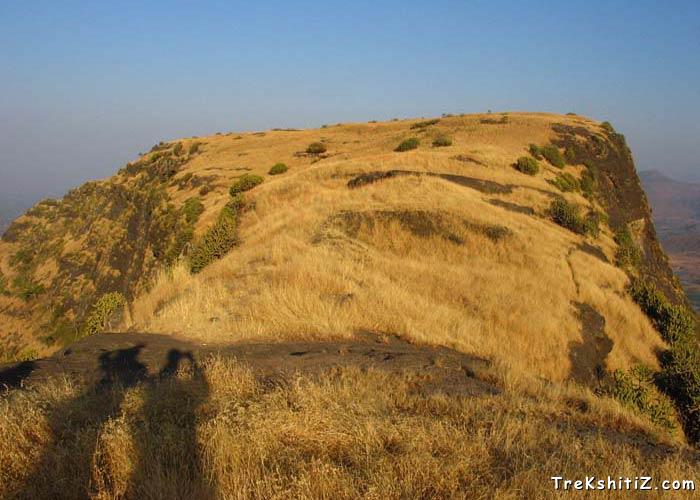
Pleateu of Kanhergad
Introduction
One of the mountain ranges of Sahyadri starts from Surgana in Nasik, and ends at Chandvad. This is called Ajanta Satmaal. Amongst the various forts in this range, Kanhergad is one of the forts which were significant in history.
Points of Interest
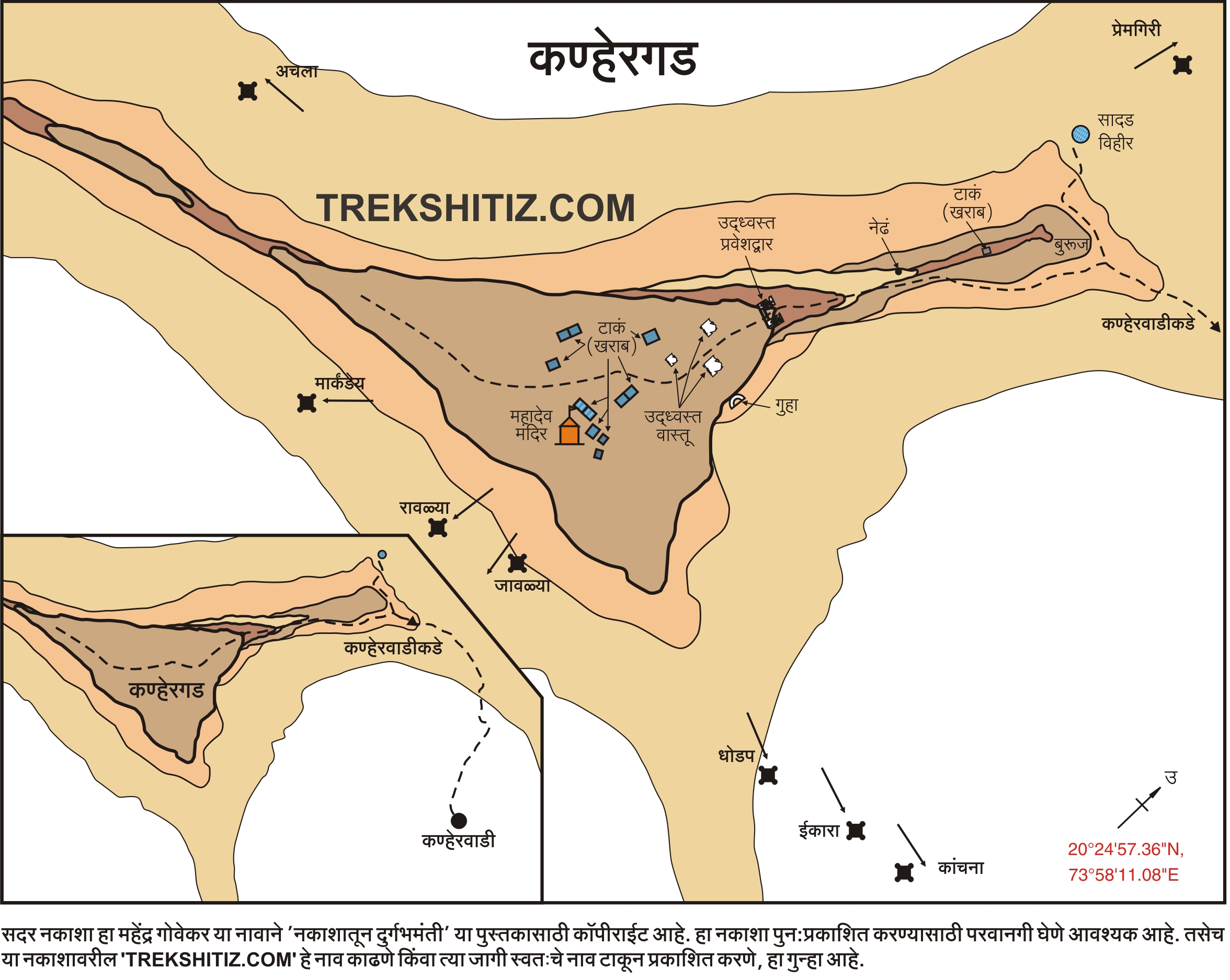
We can see a rock cut bastion on the fort, and a hole in the rock ahead of that (It is called “Nedha” by local people). The way in front of this leads to the mountain top, which is extensive. It takes around one hour to see the fort. There are 6-7 water cisterns, a ShivLing, a rock cut cave facing Dhodap fort and remnants of old mansions. We can see the forts of Saptashrungi, Markandya, Rawlya-Jawlya, Dhodap, Kanchna, and Handya from the eastern side.
How to Reach
There are 2 ways to the fort, which lead to the ridge between Kanhergad and the adjoining mountain. From here we can reach the top in an hour. One has to be careful as it is a bit steep ascent and some part has scree.
Facilities & Amenities
Accommodation
Cave on the fort are suitable for accommodation for 5-6 people.
Food
None
Water
Water tanks available for drinking water
Best Season to Visit
🌤️ N/A
Other Forts in Ajanta Satmaal
Planning Your Trek?
Pack Smart
Carry essentials, water, and first aid kit
Start Early
Begin your trek early in the morning
Trek in Groups
Always trek with companions for safety
Keep Forts Clean
Do not litter on forts. Do not damage the fort.