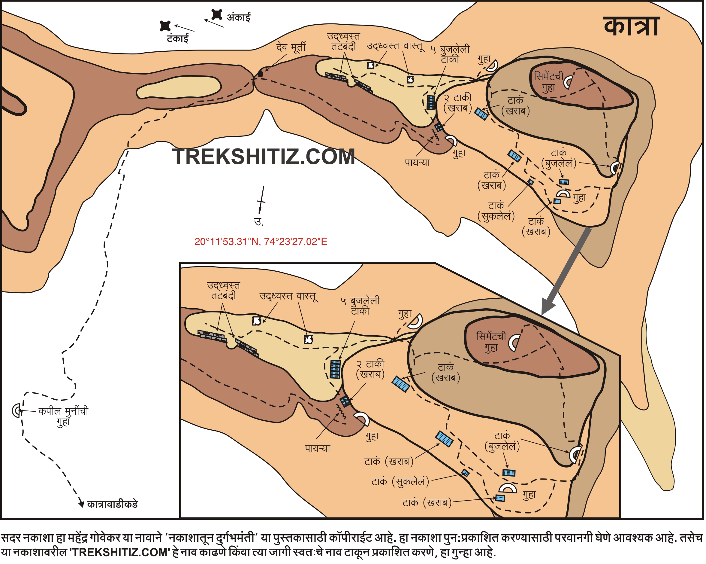
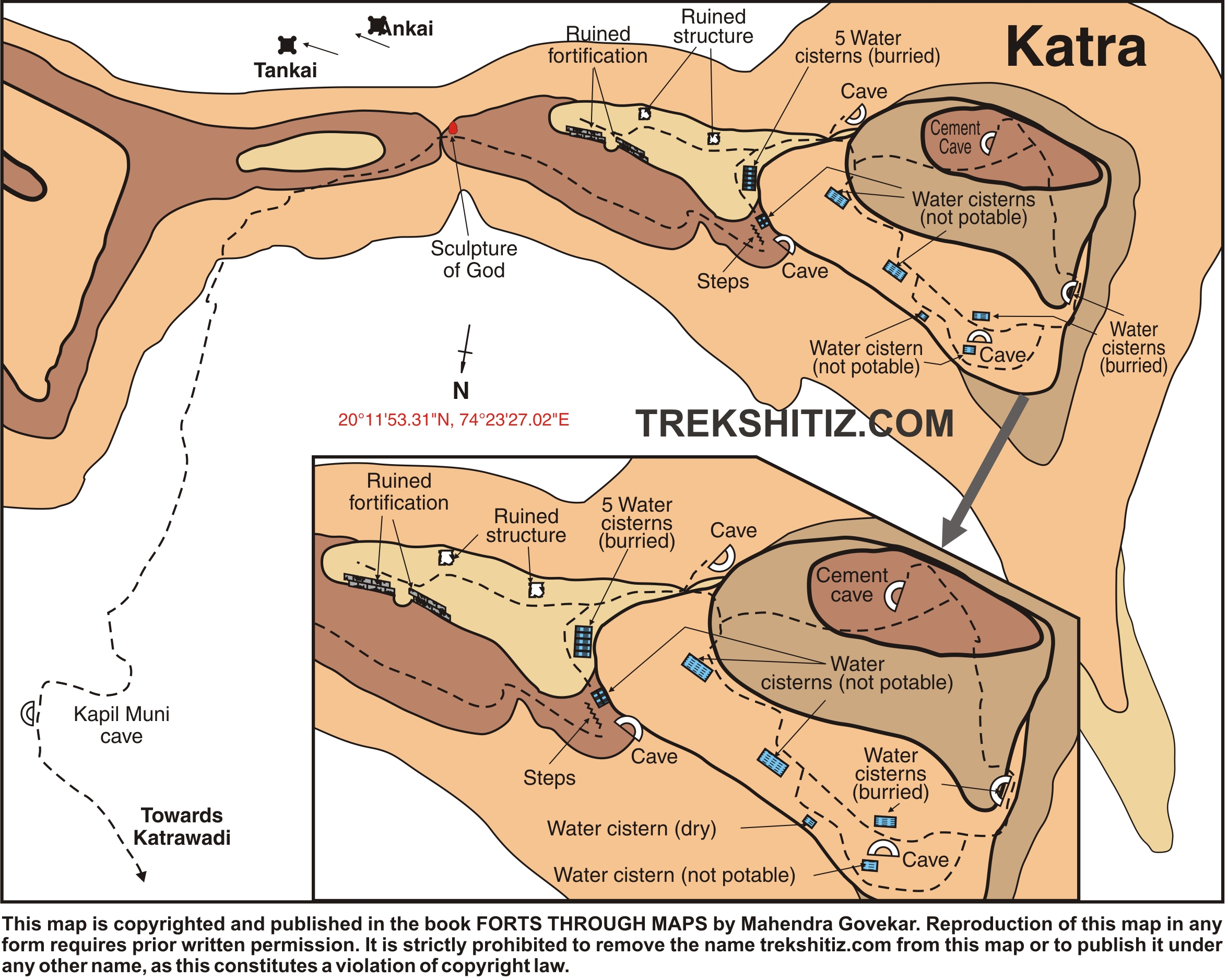
Katra
Introduction
After passing Mammad towards Aurangabad one can see a pinnacle standing tall which is known by the name of “Hadbichi Shendi” or “Thumbs Up”. Near this pinnacle there is a hill which stands separated from the Ajantha – Saatmal mountain range on which Katra fort is located.
Points of Interest
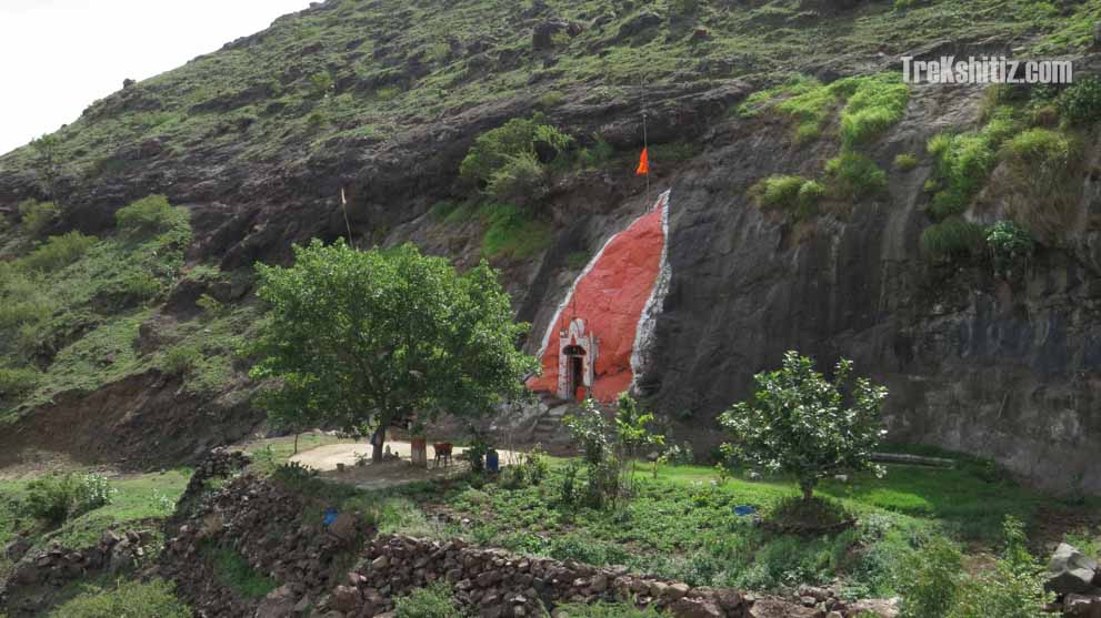
There is a small temple of Lord Shiva on the southern end of the fort and water tanks on the western end.
How to Reach
8 kms from Manmad on the Manmad – Aurangabad SH No. 10 take the right diversion from where further 2 kms is Katarwadi which is the base village of Katra fort. The fort has to be accessed from the southern side and takes 45 minutes to reach the top.
Facilities & Amenities
Accommodation
Nil. If planned to visit Ankai fort together, one can stay in Sita caves on Ankai fort.
Food
Nil
Water
Water is available in the water tanks only till December/January.
Best Season to Visit
🌤️ N/A
Other Forts in Ajanta Satmaal
Planning Your Trek?
Pack Smart
Carry essentials, water, and first aid kit
Start Early
Begin your trek early in the morning
Trek in Groups
Always trek with companions for safety
Keep Forts Clean
Do not litter on forts. Do not damage the fort.