Naneghat
Fort Images
Explore Various Images of the Fort
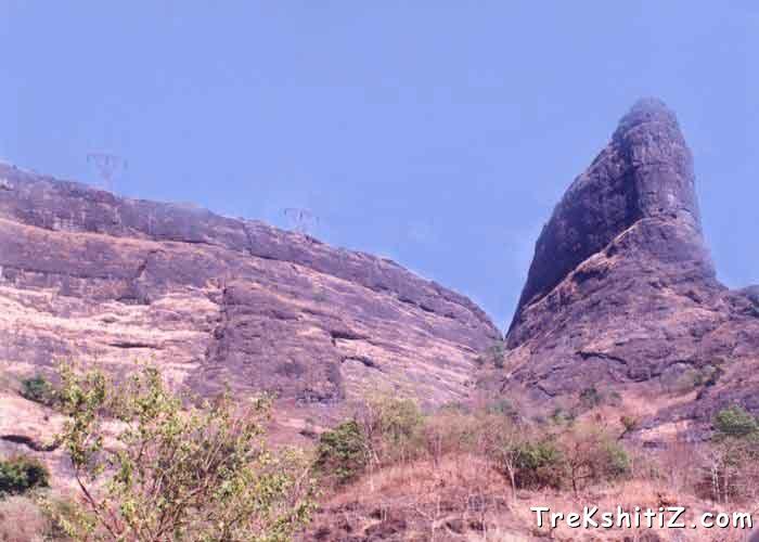
Nana's Thumb from its base
Maps & Routes
Explore detailed maps and trekking routes to reach the fort
No maps available yet
Browse All MapsIntroduction
While going through Malshej Ghat, we can easily get a glimpse of Naneghat after Murbad. The significantly shaped thumb-like peak and the pinnacle of Vandarlingi are the most distinctly seen spots. This was the most important trade route, as it connected harbour of Sopara and Kalyan directly to Junnar and Paithan. The name itself suggests that it was a famous and significant route. “Nane” means famous. Today it is a good trekking spot for trekkers and tourists.
Historical Background
Bor Ghat, Malshej Ghat and Naneghat were the foremost road links for commuting coast to the plateau. The Satvaahans had made Naneghat their main route to Junnar. During their tenure the most important way of commuting was Naneghat, which linked Kalyan & Sopara to Paithan. Today one has to reach Junnar by going all the way through Malshej, which is a big round. But Naneghat had much reduced distance and was a definitely shorter route. However, as time proceeded, it was destroyed by alien rulers and then paid no attention.
Points of Interest
The first thing we can see after reaching Naneghat is the spacious cave of Naneghat. The ancient carvings, which are seen on the walls of the cave, remind us of the Satvaahan period. Here we find inscriptions in Brahmi script all over the cave. These indicate the magnificent era of the Satvaahans and their generosity. These inscriptions are gradually being destroyed, and only a part of it is remaining. The inscriptions are very precious, and are undergoing destruction due to the negligence of Archeology.
The widely spread plateau of Naneghat is an astonishment. To the left the steps besides the cave lead us to the plateau and going to the right lead us to Nana's thumb. After climbing all the way to the bottom of the thumb, when we climb the stairs, we do not expect a big plateau. Thus this route leads directly to a higher altitude quickly, unlike Malshej Ghat, which goes all around the mountains. At the entrance to the Ghat is a big stone-made vessel like thing, in which coins as toll were put.
Facilities & Amenities
Accommodation
Nearly 50 persons can be accommodated at a time easily in the cave, which is the only place for accommodation.
Food
We have to carry our own food.
Water
Near to the cave we can find three small water reservoirs of which the last one provides the drinking water.
Best Season to Visit
🌤️ N/A
Nearby Villages
Veshakhare,Naneghat
Other Forts in Naneghat
Planning Your Trek?
Pack Smart
Carry essentials, water, and first aid kit
Start Early
Begin your trek early in the morning
Trek in Groups
Always trek with companions for safety
Keep Forts Clean
Do not litter on forts. Do not damage the fort.