Pabargad
Maps & Routes
Explore detailed maps and trekking routes to reach the fort
No maps available yet
Browse All MapsIntroduction
The forts in the Ahmednagar districts have a rustic and a raw appearance. They are very high, difficult to climb and the access to it is also not easy. The forts of Alang, Madan, Kulang, Kalsubai near Igatpuri are very famous. In the same mountain ranges on the Ghoti-Sangameshwar road there is a small fort named Pabargad. The vast spread waters of Bhandardara is opposite this fort.
Points of Interest
15 minute ascend on the path which leads to the fort top takes us to a rock patch. The route to reach the fort top is here on the upper side while the other route moves alongside the rock patch. There is a rock cut cave here and 15 people can be accommodated in it. There is another cave ahead with a water tank in it. Although the water appears to be dirty on the top, the water beneath it can be used for drinking. Going back on the main route and reaching the top, we come across three water tanks and a Shiv linga in front of it. Water is not fit to drink in these tanks. On the citadel to our left one path goes to another summit like area of the fort. On the way here there is a large water water tank. There is a sculpture of Lord Hanuman carved in this tank. As we proceed we come across another cleft but there is no route to descend from here. As we stand here, we can see remains of two house like structures on the opposite hill. There is also a water tank here but no water in it. There are rock cut steps to reach the fort top. On the top we can see a raised ground level where 4 water tanks can be seen on its bottom but the water in it isn’t potable. Adjacent to the tank there is a temple of Bhairoba and a Ganesh idol in it along with local deity called “Tandla” inscribed in stone. Patta, Ratangad, Alang, Madan, Kulang forts and Kalsubai peak can be seen from the top.
How to Reach
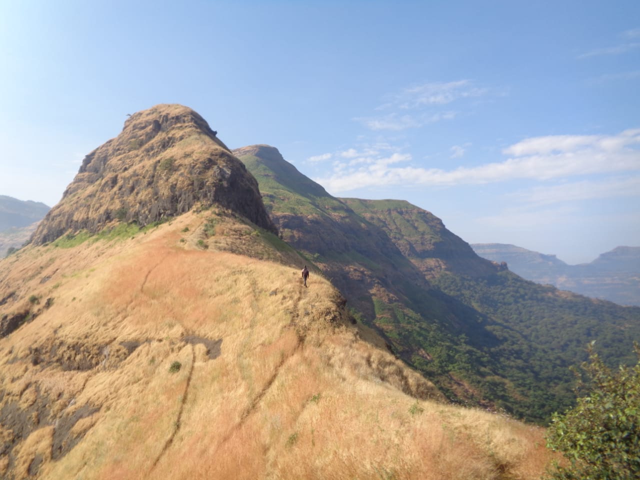
Pabargad fort is located on Bhandardara-Sangamner route. One can reach the base village Guhire on the backside on the fort by taking a bus from Igatpuri, Ghoti, Sangamner, Pune or Akole. The fort can’t be seen from the village as a huge mountain blocks its view. Thus we have to reach the plateau area above the village level to get its glimpse. A small path behind the Lord Hanuman temple in the village goes to the fort. There is a water tank built on the way. As we move ahead we come across a rock wall. Keep it to the right and proceed to move on its top. There is a flat area above the rock wall with many trees on it. The edge of the fort can be seen from here. One of the ridges of a mountain opposite the fort connects here. One has to start climbing this ridge and after a 30 minute trail the path turns right and moves towards the fort by keeping the cliff to the left. In 20 minutes we reach the cleft between the fort and the hill opposite to it. There is a rock patch here which climbed takes us to the fort summit.
Trek Duration
⏱️ 3 hours from Guheri village
Facilities & Amenities
Accommodation
Available in the caves on the fort
Food
Not available
Water
Available in the tanks on the fort
Best Season to Visit
🌤️ N/A
Other Forts in Kalsubai
Planning Your Trek?
Pack Smart
Carry essentials, water, and first aid kit
Start Early
Begin your trek early in the morning
Trek in Groups
Always trek with companions for safety
Keep Forts Clean
Do not litter on forts. Do not damage the fort.