Parvatgad
Introduction
Sonewadi Village is located in Nashik district in sinnar tehsil near bhatghar dam on sinnar-akole road. Songad and Parvatgad are located behind this village. We can complete two forts in one day.
Points of Interest
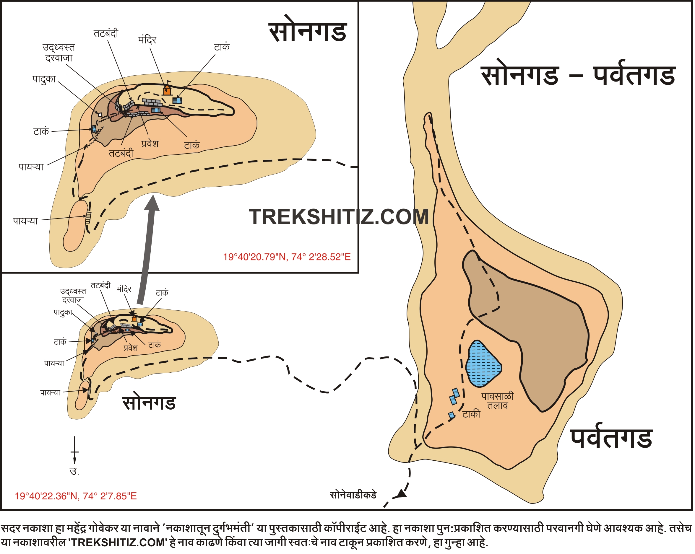
Jilha parishad school in sonewadi is roadside. In front of school there is a cement road which leads to sonewadi. After walking for 5 mins we reach to a raw road. After crossing the road we reach the base of the hill. There are few houses on the hill so there are few steps to reach the hill. After climbing the steps for 5 mins we reach the top of the hill.After ascending the hill we reach on a large plateau. The hill on the right side of the large plateau is Parvatgad and on the left side is the Songad. The route leading to both the forts goes through the pass between the two forts. After walking for 15 min we reach at the pass between the two forts.
There is small hill in the pass between the forts the road going towards the left is for Songad. The road going towards right side leads us to Parvatgad. After ascending for 15 min we reach on a small plateau. After ascending for 5 min through Babhali we reach at the rock patch. This rock patch is steep to climb. After climbing for 10 min we reach at the top of the fort. There are huge catctus trees on the top. We reach at the water lake after walking through the cactus trees for 10 min. there are three water tanks on the left of this water lake. One of which is partially buried in the soil.
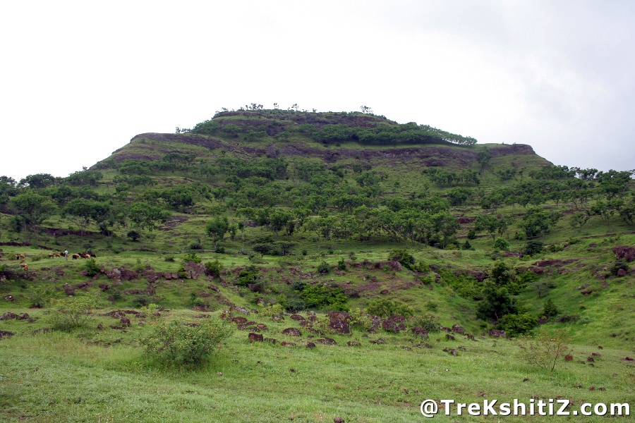
From the top of the fort we are able to see Aad, Dubera, Songad fortrs and Bhatghar Dam. 45 mins approx are required to climb the fort from the pass.
How to Reach
The base village of the Songad and Parvatgad is Sonewadi. To reach Sonewadi we first have to reach Sinnar from Mumbai. On Sinnar-Pune road there is a turn at 10 km for Gondewadi. This road is upto Akole. on this road Gondewadi-Dapur-Chapadgaon-Sonewadi distance is 16 Km. Sonewadi-Akole distance is 17 Km. Sinnar-Sonewadi distance is 23 Km. Sonewadi-Nashik distance is 53 Km. From Sinnar and Akole there are S.T. buses available at an interval of 30 mins. Jeeps are also available from Sinnar and Gondewadi towards Sonewadi.
Trek Duration
⏱️ 1 hr from base
Facilities & Amenities
Accommodation
There is no facility to stay on the fort. We can stay in the school located in the village.
Food
Nil
Water
Nil
Best Season to Visit
🌤️ June to February
Other Forts in Songad and Parvatgad
Planning Your Trek?
Pack Smart
Carry essentials, water, and first aid kit
Start Early
Begin your trek early in the morning
Trek in Groups
Always trek with companions for safety
Keep Forts Clean
Do not litter on forts. Do not damage the fort.