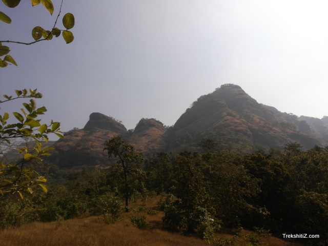
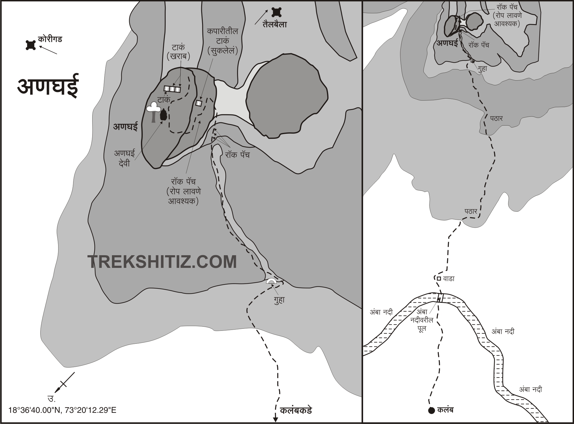
From Anghai village one can see three peaks. Anghai fort is the one to the left. The path goes through the fields and in 15 minutes we reach the bridge on Amba river. To the left side of this bridge is a tree which the locals have named as “Buruna Doh”. After crossing the bridge we can see a hill covered with a lot of trees. After a 5 minute climb on this hill we come across a Mango orchard and a house. A path going near this house takes us in the pass between Anghai fort and the peak to its right. After we cross the Mango orchard there is a patch of dense forest. A 15 minute trail from here takes us to a flat ground and beyond this again there is a cover of dense forest. There are signs marked from here which lead us to the cleft between the two peaks/hills. There is a rock patch here of approximately 15 ft with hold in it for grip. To bypass this rock patch one can go to the right where the rock patch wall ends and here one can climb with the support of holds in the rock and nearby trees. After crossing this patch we come across a cave to the left. To the right side of this cave there are rock cut steps which take us to the base of the cleft which goes to the fort.
There are many fallen rocks in the cleft and the ascend is about 70-80 degrees vertical after which we reach about half its height. Here the path is closed so one has to go to the rock patch which is sideways. This 10 ft rock patch has 6 rock cut steps towards its end part. These may be buried under mud which we have to check properly. After the steps we come to the upper part of the rock patch. From the first rock patch to the third rock patch it takes about 45 minutes to reach. As we continue moving in the cleft, we reach the pass between the fort and the hill which is to the right in 15 minutes. There is a dense forest cover in the last patch. Going further there is another patch of rock cut steps after which there is another rock patch beyond which we reach the fort top. On the summit there is a temple of Goddess Anghai and three water tanks. Tail Baila and Sudhagad forts can be seen from the top.
|
| Ways To Reach : |
One has to reach Khopoli. On the Khopoli - Pali route, at 29 kms from Khopoli there is a diversion for Jambhulpada. From here a road takes us to Kalamb village at 6 kms. Mumbai - Khopoli - Kalamb distance is 87 kms.
Reach Khopoli by train. Then board a bus for Pali and alight at Parali village from where auto rickshaws are available to reach Kalamb village.
|
| Accommodation Facility : |
| Nil |
| Food Facility : |
| Available in Pali, Khopoli |
| Drinking Water Facility : |
| Nil |
| Time To Reach : |
| 3 hrs 30 mins from Kalamb village |
| Best Season To Visit : |
| October to March |

