| Fort Name : | Alphabetically | RangeWise | DistrictWise | CategoryWise | GradeWise |
| Katra | FortHeight : 2680 | ||||||
| Type : Hill forts | Fort Range : Ajanta Satmaal | ||||||
| District : Nashik | Grade : Medium | ||||||
| After passing Mammad towards Aurangabad one can see a pinnacle standing tall which is known by the name of “Hadbichi Shendi” or “Thumbs Up”. Near this pinnacle there is a hill which stands separated from the Ajantha – Saatmal mountain range on which Katra fort is located. | |||||||
|
|||||||
| Fascinating Spots : | |||||||
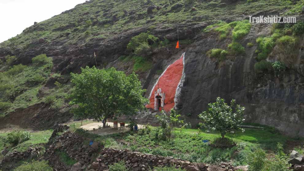
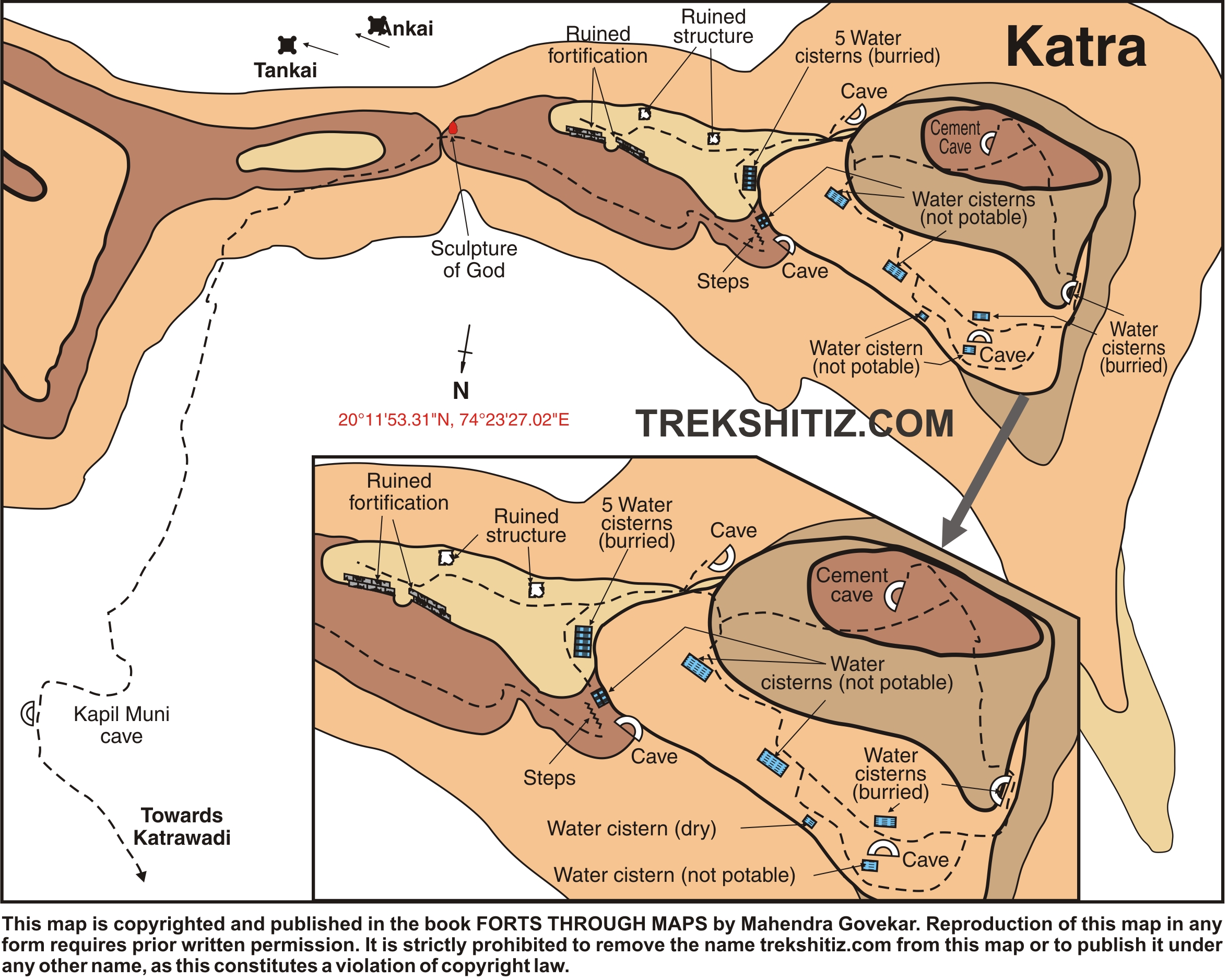
| There is a small temple of Lord Shiva on the southern end of the fort and water tanks on the western end. | |
| Ways To Reach : | |
| 8 kms from Manmad on the Manmad – Aurangabad SH No. 10 take the right diversion from where further 2 kms is Katarwadi which is the base village of Katra fort. The fort has to be accessed from the southern side and takes 45 minutes to reach the top. | |
| Accommodation Facility : | |
| Nil. If planned to visit Ankai fort together, one can stay in Sita caves on Ankai fort. | |
| Food Facility : | |
| Nil | |
| Drinking Water Facility : | |
| Water is available in the water tanks only till December/January. |
| Marathi Version |
| Forts in the range of Ajanta Satmaal | Achala | Hatgad | Indrai | Kanchan |
| Kanhergad(Nashik) | Katra | Markandeya | Rajdeher |
| Rajdher | Rawlya - Jawlya | Saptashrungi | |