Gambhirgad
Maps & Routes
Explore detailed maps and trekking routes to reach the fort
No maps available yet
Browse All MapsIntroduction
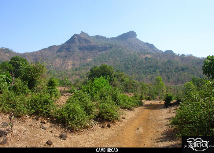
Gambhir in Marathi means ‘serious’. So, Gambhirgad and its environment is according to its name quite ‘serious’. Situated in Thane district and on Gujarat border, it is probably the last fort in Thane district.
Points of Interest
Approaching the fort, we first reach the plateau which is the machi of the fort. It has lot of uncontrolled growth of wild plants. There is nothing much to see on the machi. We take right from here to reach top of the fort. We come across a beautiful water tank along this way. The water is usable but a rope is necessary to take it out. Moving further, we reach stairs. The climb further is such that we have to move with a cliff on our right. It takes around 15 minutes to reach the top. On exploring the fort of right side, we see remnants of some construction. There is also a temple of a goddess. Also we have 1-2 water tanks buried under soil due to erosion. Other than this there is not much to observe. We return to explore remaining part of the fort, on the left. One can certainly see evidences of now extinct curtain wall. We climb down by this side. On way down we come across 2-3 water tanks. Some small pinnacles on the way also grab our attention. One and half hour is enough to explore the fort. Mahalakshmi pinnacle and forts namely Asheri and Adsul are visible from this fort.
Trek Duration
⏱️ 2 hours from Patilwadi.
Facilities & Amenities
Accommodation
Accommodation facility is not available on the fort
Food
One has to make his own food arrangements
Water
Drinking water is available in the tank but rope is necessary to take it out.
Best Season to Visit
🌤️ N/A
Other Forts in Palghar
Planning Your Trek?
Pack Smart
Carry essentials, water, and first aid kit
Start Early
Begin your trek early in the morning
Trek in Groups
Always trek with companions for safety
Keep Forts Clean
Do not litter on forts. Do not damage the fort.