Kohoj
Introduction
Very few forts, to the north of Mumbai in Palghar region of Thane district, are still showing their existence, among which is the fort of Kohoj. This fort lies at about 10 to 11 kms. from Wada on the route of Wada – Palghar.
Historical Background
Very few of the historical evidences are coherent to this fort. Looking at its well-dug cisterns, the fort can be said to be belonging to Bhoj-period. But no such evidences are available. In 16th century, Portuguese captured this fort from the King of Gujarat. They constructed fortifications and bastions on this fort. Later, in 18th century, Peshwe conquered this fort in their campaign of 1737. Afterwards the fort remained under the British rule.
Points of Interest
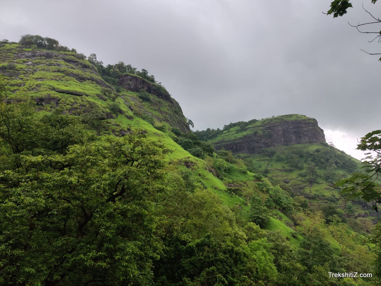
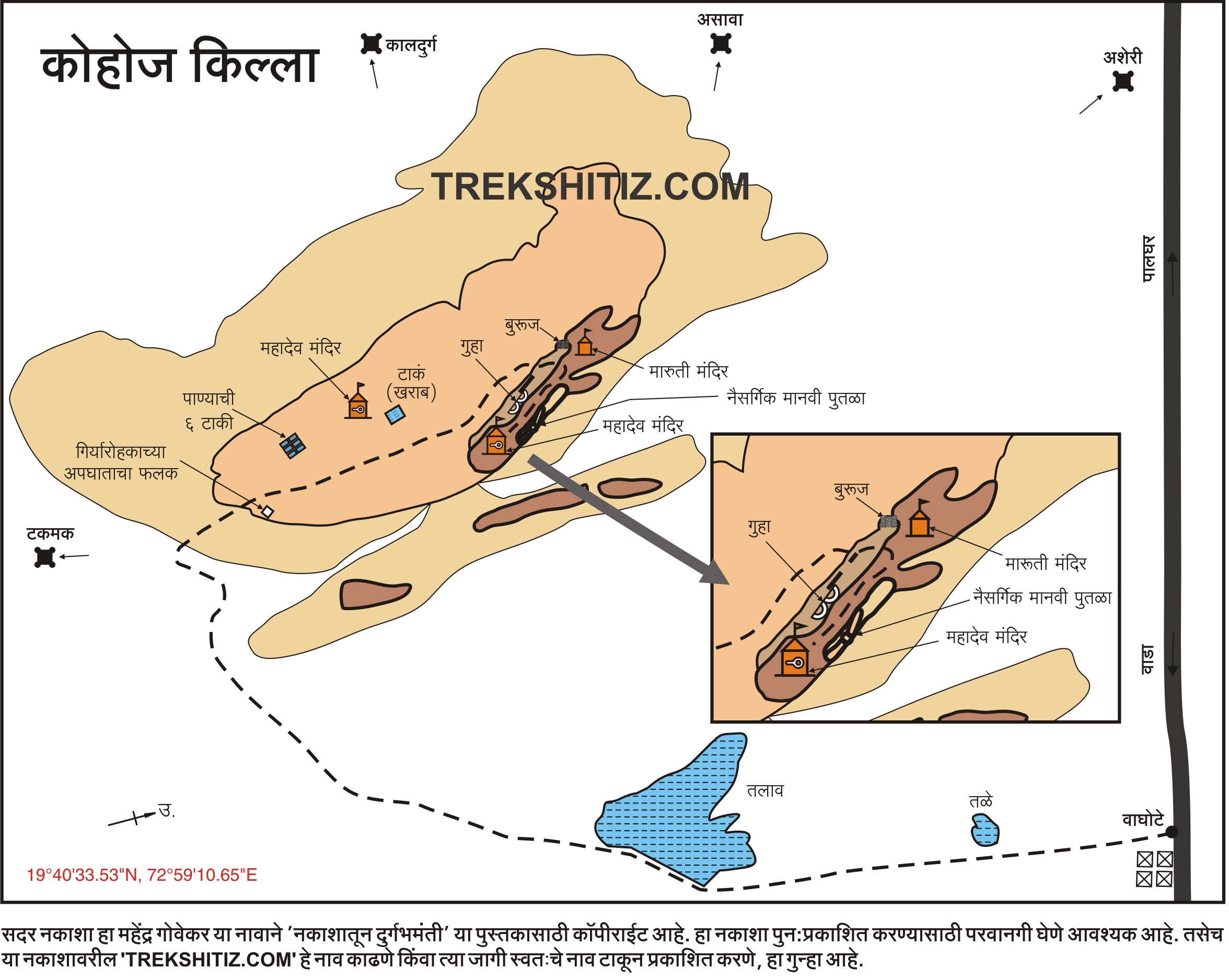
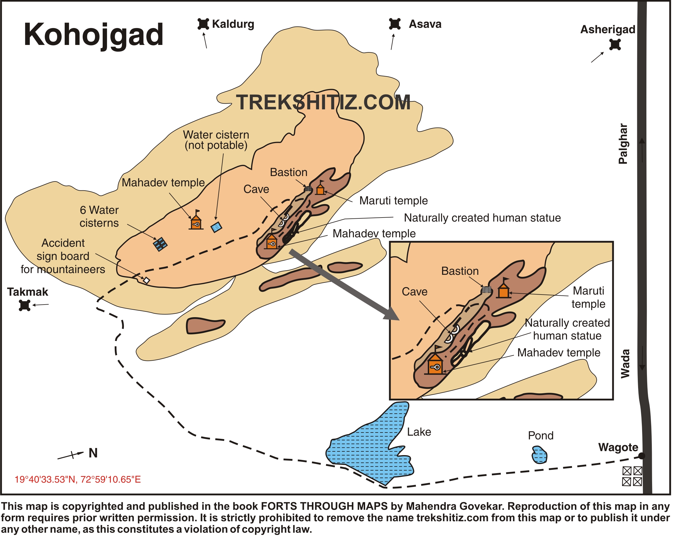
On reaching the plateau of the fort, a temple of Lord Shankar can be seen, which has now been rehabilitated. Two cisterns can be seen in front of the temple. One of the routes descends from the left side of the temple, where seven adjoined cisterns are located. One of the cisterns bears clean water. The other two cisterns have been spoiled, the remaining four being clogged. Few remnants in dilapidated state can be seen to the right of the temple. Fortification is also seen at some of the places on the fort. The other way stretches from the right side of the temple up the hill. Three large cisterns can be seen on this route, one of which is clogged and the other two contain water. This water can be used for drinking. An idol of Lord Hanumana can be seen near these cisterns.
Making headway along this route we reach near the bastion, which is now in a dilapidated state. A temple of Lord Hanumana is located to the left of this bastion. From here, we climb up the steps and within 15 minutes of walk reach at the top of the fort. Here we come across many natural pinnacles formed due to wind-erosion. A man-shaped pinnacle is one of the greatest wonder of nature’s creation. This is the most attractive place on the fort. Different shapes of this pinnacle are evident when viewed from various directions. A temple of Lord Krishna is situated ahead along this route.
Trek Duration
⏱️ About 2 hours are required to climb up the fort via Vaghote village.
Facilities & Amenities
Accommodation
There as such no residing place on the fort. The temple of Lord Shiva can hardly accommodate two persons at a time.
Food
One has to make the food arrangement on its own.
Water
There is a perennial source of drinking water on the fort.
Best Season to Visit
🌤️ N/A
Other Forts in Palghar
Planning Your Trek?
Pack Smart
Carry essentials, water, and first aid kit
Start Early
Begin your trek early in the morning
Trek in Groups
Always trek with companions for safety
Keep Forts Clean
Do not litter on forts. Do not damage the fort.