Ranjangiri
Introduction
Nasik has been a major trade centre and market from ancient times. The goods from Dahanu port were transported to Nasik via Jawhar – Gondaghat – Amboli ghat. Ranjangiri is situated in the Trimbakeshwar range in Nasik district, built to protect this route, along with Basgad, Harshgad, Anjaneri and Bhupatgad (near Jawhar).
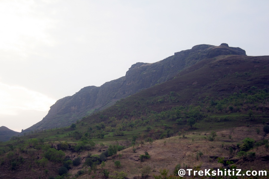
Since the pinnacle on the south of the fort is of the shape of a spouted pitcher or “Ranjan” in Marathi.
Points of Interest
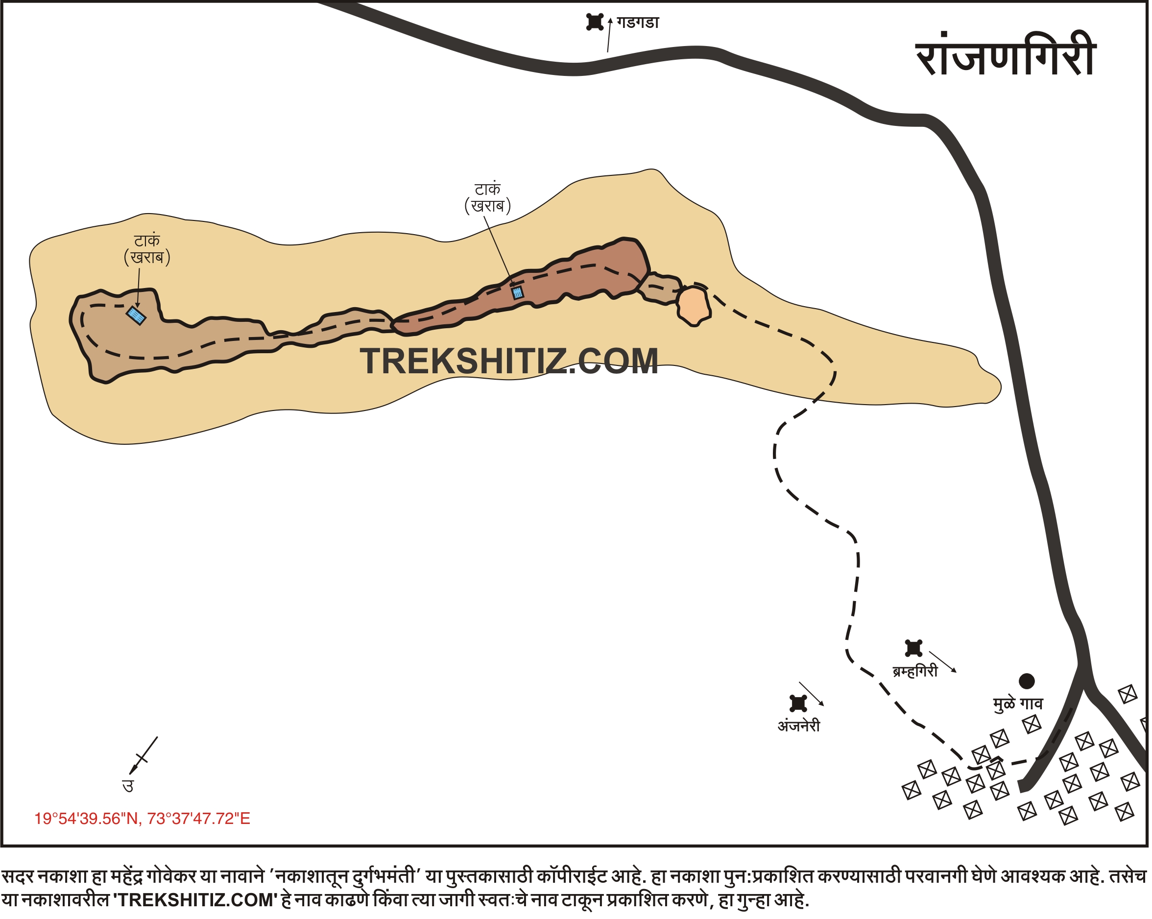
To reach to the topmost part, the way is around the pinnacle. The entrance, ramparts and bastions have been completely destroyed. There are 2 tanks on the fort. To climb the pinnacle, basic climbing techniques can be used.
How to Reach
Mulegaon is the base village of Ranjangiri. The road to Mulegaon starts 15 km before Nasik on Mumbai-Nasik highway. It takes one hour to reach the top from the base.
Facilities & Amenities
Accommodation
None
Food
None
Water
None
Best Season to Visit
🌤️ N/A
Other Forts in Trimbakeshwar
Planning Your Trek?
Pack Smart
Carry essentials, water, and first aid kit
Start Early
Begin your trek early in the morning
Trek in Groups
Always trek with companions for safety
Keep Forts Clean
Do not litter on forts. Do not damage the fort.