Trimbakgad
Introduction
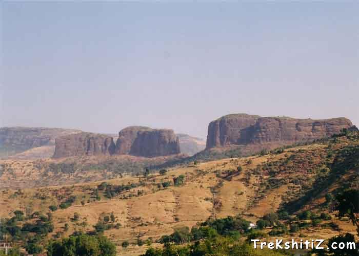
This mountain range of Trimbak falls to the West of Nashik district and North of Igatpuri. In the first stage of this hill range we can find Basgad fort, Utwad, Fanicha dongar, Harihar fort and the second range has Bramhagiri, Anjaneri, Ghargad forts. In the ancient times one of the trade routes from Maharashtra to Gujarat used to pass through this hill range and Bramhagiri fort was built for its protection. Since the medieval period this fort has been unconquered. This fort is well known for one of the 12 Jyotirlingas of Lord Shiva which is called as Trimbakeshwar.
Points of Interest
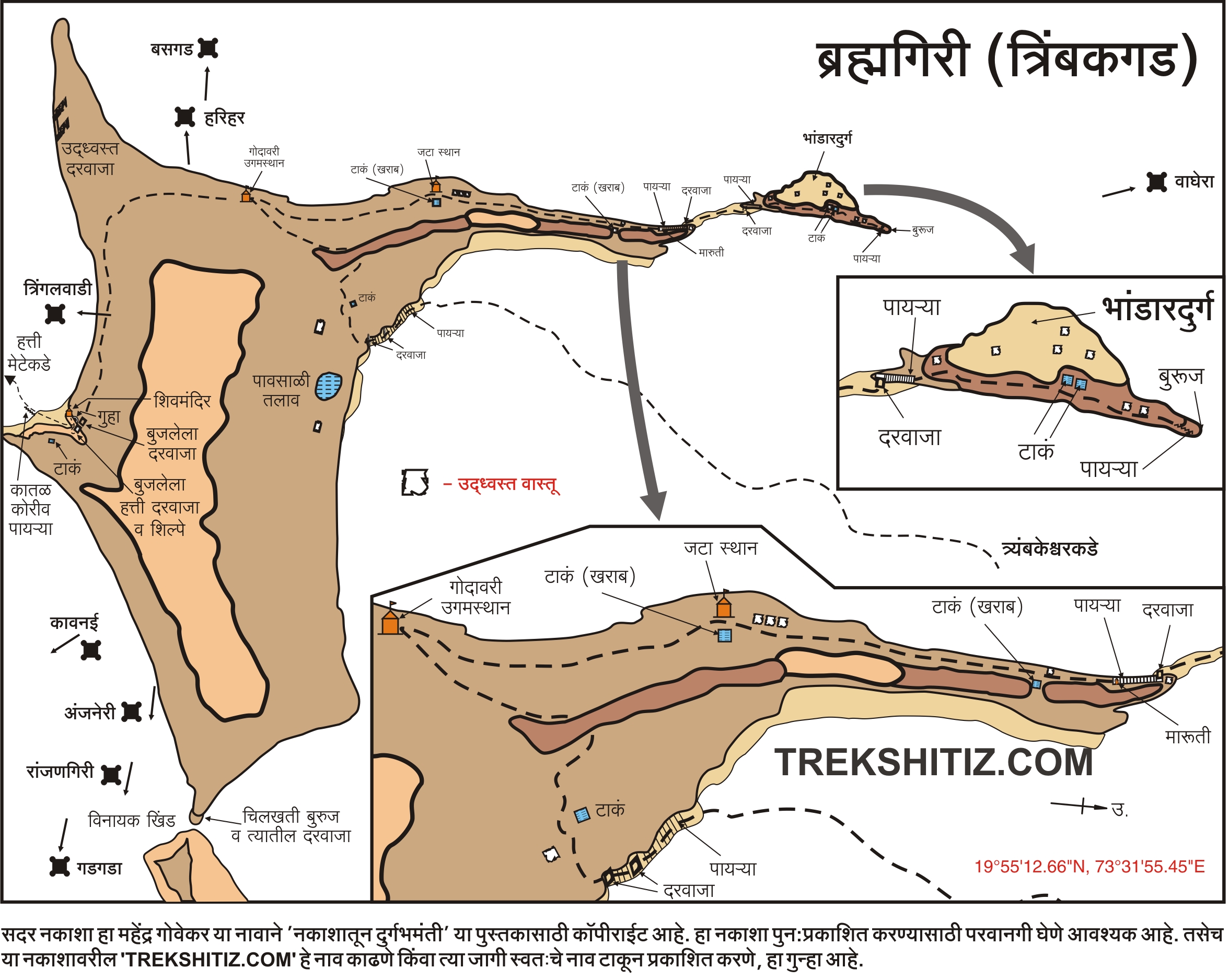
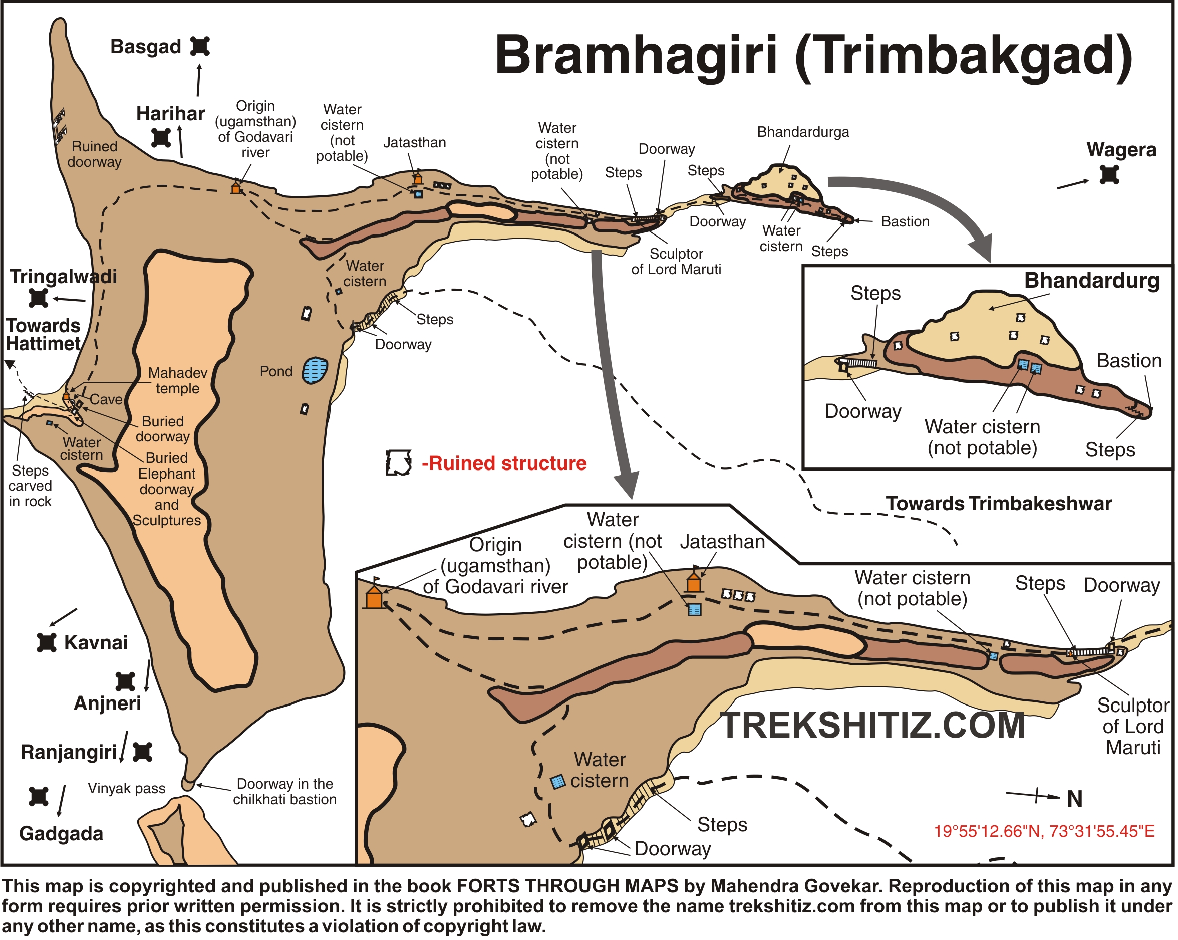
The top summit of this fort is a large plateau. Once you reach here continue walking towards the small raised hill which is seen afar. While we are on the trail, one path goes to the left towards a cave named “Siddhagufa”. Continuing on the path ahead we come across a diversion. Take the right one to reach a temple in 15 minutes. This is the spot from where the river Godavari originates. After seeing this proceed to the path on the left which takes us to another temple in 10 minutes. It was here that Lord Shiva made Godavari River to land on our Earth by lashing his long strands of hair. There are remnants of structures on the fort. Anjaneri and Harihar forts can be seen from the top.
How to Reach
Reach Gangadwar in Trimbakeshwar village. From the stairs which start here a path goes to the left which takes us to another set of stairs and further up the fort via rock cut caves.
Trek Duration
⏱️ 1.5 hrs from Trimbakeshwar temple.
Facilities & Amenities
Accommodation
Available at base village.
Food
Available at base village.
Water
Available in the water tanks on the fort.
Best Season to Visit
🌤️ N/A
Other Forts in Trimbakeshwar
Planning Your Trek?
Pack Smart
Carry essentials, water, and first aid kit
Start Early
Begin your trek early in the morning
Trek in Groups
Always trek with companions for safety
Keep Forts Clean
Do not litter on forts. Do not damage the fort.