Shirgaon
Fort Images
Explore Various Images of the Fort
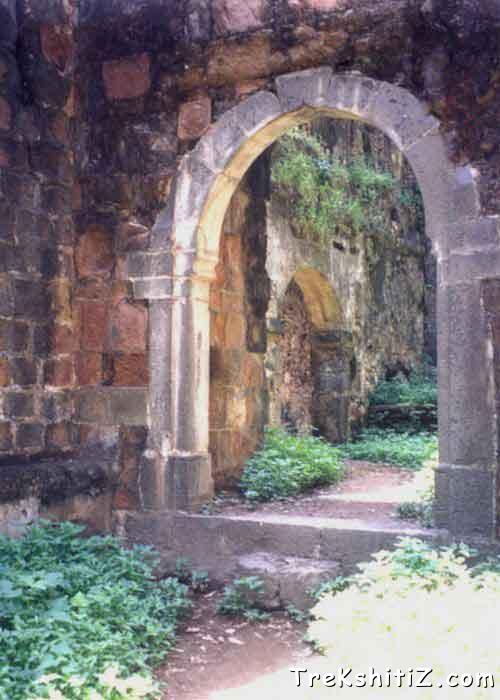
Door Of Shirgaon Temple
Introduction
The fort of Shirgaon is 5 km north of Mahim in Palghar Taluka. Seashore behind the fort is very beautiful, but is lonely as the fort is quite neglected.
Historical Background
In 1739 Marathas won this fort along with the forts of Dahanu, Kelve and Tarapur. It belonged to Portuguese before Marathas. Afterwards in 1818 Britishers captured it like the other forts.
Points of Interest
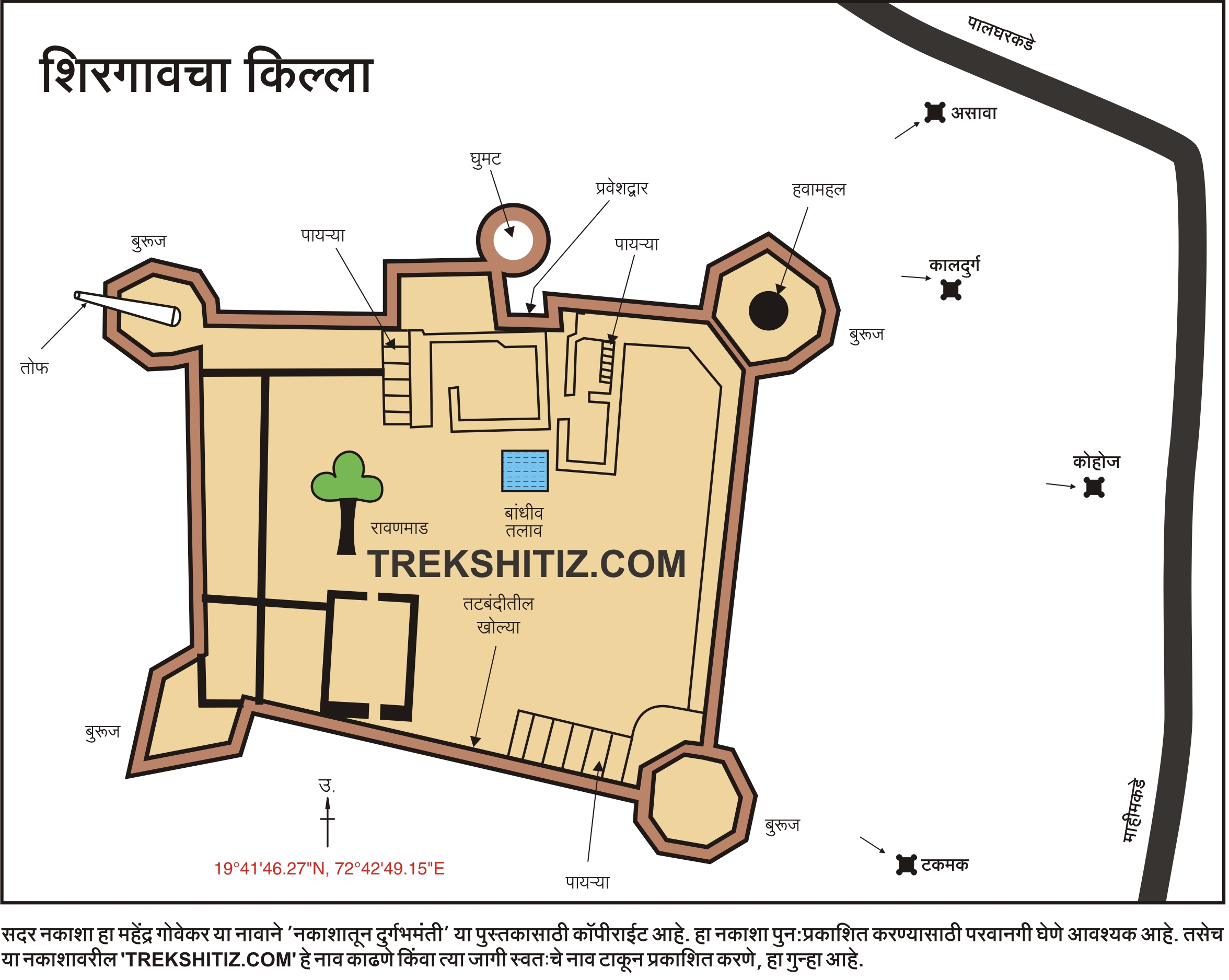
The fort of Shirgaon is about 200 feet in length and 150 feet wide. The rampart of fort is 35 feet in height and 10 feet in width. There are four bastions at the four corners of the fort and one at the entrance. Above the entrance there is a nicely built pedestal which reminds us the memorial of Shivaji Maharaj.
To reach the on the rampart and bastions there are steps on the outer side as well as on the inner side of the rampart. Those on the inner side are not in use today.
There is one more entrance at the western rampart of the fort. It is not in use nowadays. From the rampart we see the beautiful seashore.
How to Reach
From Virar, which is the last station on western railway, board either shuttle or mail to reach Palghar station. From Palghar there are buses after every half an hour running on Satpati road. Take the bus and get down at the “Masjid” stop, which takes about 15 minutes. Auto-rickshaws are also available to reach this stop from Palghar station.
After a walking distance of about 10 minutes we reach base of the fort. There is a school at the base.
Facilities & Amenities
Accommodation
Complete fort can be seen within 45 minutes hence no need to stay. If required, arrangement can be made in the school.
Food
At Palghar hotels are available.
Water
Not available on fort.
Best Season to Visit
🌤️ N/A
Nearby Villages
Loharnaka,Shirgaon
Other Forts in Konkan
Planning Your Trek?
Pack Smart
Carry essentials, water, and first aid kit
Start Early
Begin your trek early in the morning
Trek in Groups
Always trek with companions for safety
Keep Forts Clean
Do not litter on forts. Do not damage the fort.